
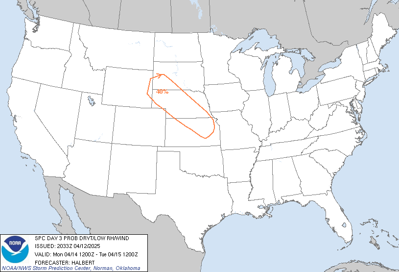
Day 3 Probabilistic Fire Weather Outlooks:
Probability of dry thunderstorms with dry fuels within 12 miles of a point denoted by scalloped lines for
- Critical Area - 40% (blue)
- Marginal Area - 10% (brown)
Probability of strong winds, low RH, and warm temperatures concurrent for at least 3 hours with dry fuels within 12 miles of a point denoted by solid lines for
- Critical Area - 70% (red)
- Marginal Area - 40% (orange)

Day 4 Probabilistic Fire Weather Outlooks:
Probability of dry thunderstorms with dry fuels within 12 miles of a point denoted by scalloped lines for
- Critical Area - 40% (blue)
- Marginal Area - 10% (brown)
Probability of strong winds, low RH, and warm temperatures concurrent for at least 3 hours with dry fuels within 12 miles of a point denoted by solid lines for
- Critical Area - 70% (red)
- Marginal Area - 40% (orange)

Day 5 Probabilistic Fire Weather Outlooks:
Probability of dry thunderstorms with dry fuels within 12 miles of a point denoted by scalloped lines for
- Critical Area - 40% (blue)
- Marginal Area - 10% (brown)
Probability of strong winds, low RH, and warm temperatures concurrent for at least 3 hours with dry fuels within 12 miles of a point denoted by solid lines for
- Critical Area - 70% (red)
- Marginal Area - 40% (orange)
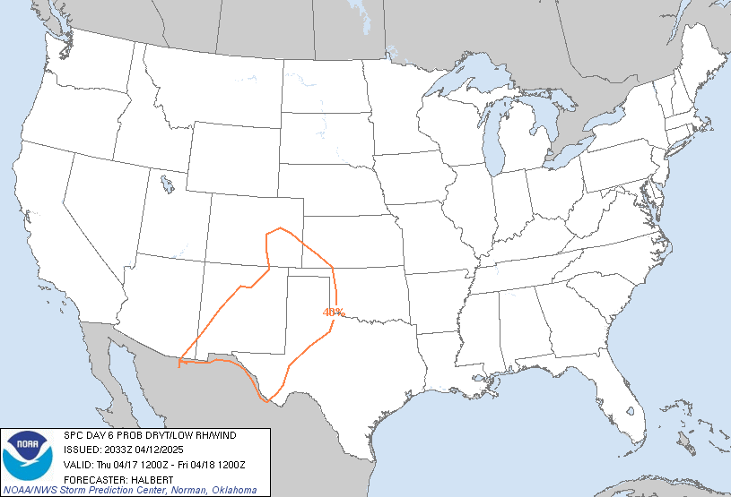
Day 6 Probabilistic Fire Weather Outlooks:
Probability of dry thunderstorms with dry fuels within 12 miles of a point denoted by scalloped lines for
- Critical Area - 40% (blue)
- Marginal Area - 10% (brown)
Probability of strong winds, low RH, and warm temperatures concurrent for at least 3 hours with dry fuels within 12 miles of a point denoted by solid lines for
- Critical Area - 70% (red)
- Marginal Area - 40% (orange)
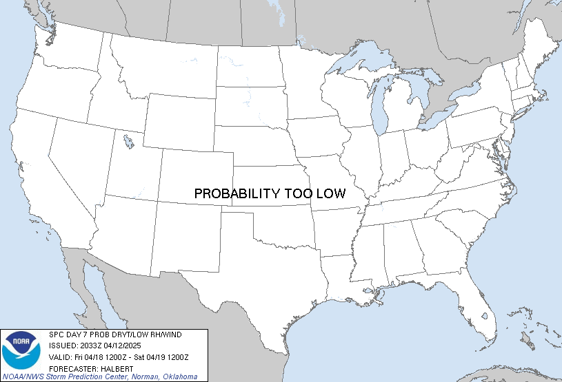
Day 7 Probabilistic Fire Weather Outlooks:
Probability of dry thunderstorms with dry fuels within 12 miles of a point denoted by scalloped lines for
- Critical Area - 40% (blue)
- Marginal Area - 10% (brown)
Probability of strong winds, low RH, and warm temperatures concurrent for at least 3 hours with dry fuels within 12 miles of a point denoted by solid lines for
- Critical Area - 70% (red)
- Marginal Area - 40% (orange)

Day 8 Probabilistic Fire Weather Outlooks:
Probability of dry thunderstorms with dry fuels within 12 miles of a point denoted by scalloped lines for
- Critical Area - 40% (blue)
- Marginal Area - 10% (brown)
Probability of strong winds, low RH, and warm temperatures concurrent for at least 3 hours with dry fuels within 12 miles of a point denoted by solid lines for
- Critical Area - 70% (red)
- Marginal Area - 40% (orange)
| ||||||||
| D3 | Mon, Apr 14, 2025 - Tue, Apr 15, 2025 | D6 | Thu, Apr 17, 2025 - Fri, Apr 18, 2025 |
| D4 | Tue, Apr 15, 2025 - Wed, Apr 16, 2025 | D7 | Fri, Apr 18, 2025 - Sat, Apr 19, 2025 |
| D5 | Wed, Apr 16, 2025 - Thu, Apr 17, 2025 | D8 | Sat, Apr 19, 2025 - Sun, Apr 20, 2025 |
| (All days are valid from 12 UTC - 12 UTC) | |||
   ZCZC SPCFWDD38 ALL
   FNUS28 KWNS 122033

   Day 3-8 Fire Weather Outlook
   NWS Storm Prediction Center Norman OK
   0333 PM CDT Sat Apr 12 2025

   Valid 141200Z - 201200Z

   A dry and breezy post-frontal airmass across the Central Plains,
   associated with an eastward moving mid-level shortwave trough, will
   result in some elevated fire-weather concerns on D3/Monday from
   southwest South Dakota/northwest Nebraska into northeastern Kansas.
   By D4/Tuesday, generally west-southwesterly flow will overspread the
   Southwestern U.S., where deep mixing will transport momentum
   downward into a warm, dry boundary layer. The ECMWF also indicates
   some potential for an embedded shortwave trough to move from Baja
   into the Four Corners, which could provide some enhancement to the
   surface winds and associated fire-weather concerns. On D5/Wednesday,
   a surface cyclone is forecast to develop in the lee of the Rockies
   beneath generally zonal mid-level flow. Deep boundary layer mixing
   on the west side of a dryline will result in some heightened
   fire-weather concerns across portions of the western Texas Panhandle
   into eastern New Mexico. Heading into D6/Thursday, a mid-level
   trough is forecast to move from the Pacific Northwest into the Great
   Basin, with fairly good agreement from both the ECMWF and GFS
   deterministic and ensemble forecasts. This will result in an
   intensifying 500mb height gradient across the southern Rockies,
   along with a deepening of the forecast surface low over the
   Central/Northern plains. The response in surface winds will result
   in widespread 20-25 MPH winds across portions of West Texas, eastern
   New Mexico, and southern Colorado with relative humidity values at
   or below 10%. Future outlooks for D6/Thursday may need an upgrade to
   70% Critical pending continued forecast consistency and agreement
   between ensembles. While some fire-weather threat may persist into
   D7/Friday and D8/Saturday across the Southern Plains, predictability
   is too low for any highlight areas at this time.

   ..Halbert.. 04/12/2025

   ...Please see www.spc.noaa.gov/fire for graphic product...

   $$

   CLICK TO GET FNUS38 KWNS PFWF38 FIRE WEATHER OUTLOOK DAY 3-8 AREAL OUTLINE PRODUCT