|
| Mesoscale Discussion 57 |
|
< Previous MD Next MD >
|
|
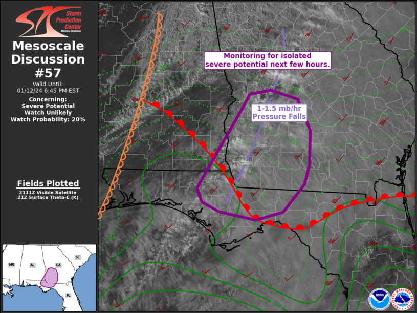
   Mesoscale Discussion 0057
   NWS Storm Prediction Center Norman OK
   0318 PM CST Fri Jan 12 2024

   Areas affected...much of southwest Georgia and parts of the Florida
   Panhandle

   Concerning...Severe potential...Watch unlikely

   Valid 122118Z - 122345Z

   Probability of Watch Issuance...20 percent

   SUMMARY...Isolated strong storms cannot be ruled out over the next
   couple hours, from the Florida Panhandle into southwest Georgia.

   DISCUSSION...Surface analysis shows a dryline roughly bisecting AL
   and extending into the northern Gulf of Mexico, with a warm front
   from southern AL into northern FL. Relatively cool air remains in
   place over the TLH area, with warming noted into southwest GA. A
   small plume of 66-70 F dewpoints currently exist over the western FL
   Panhandle into far southwest GA, resulting in around 1000 J/kg
   MLCAPE.

   Strong wind fields remain over the area, with 850 mb southwesterlies
   over 60 kt. Boundary-layer mixing is aiding surface gusts of 25-35
   kt with gradual theta-e recovery. Veering and increasing winds with
   height still conditionally support supercell and tornado risk, but
   overall ascent remains limited. As such, the area is being monitored
   for more robust storm initiation over the next few hours. A better
   chance at isolated severe storms would exist should the cool air
   over the FL Panhandle/southern GA finally modify.

   ..Jewell/Thompson.. 01/12/2024

   ...Please see www.spc.noaa.gov for graphic product...

   ATTN...WFO...FFC...TAE...

   LAT...LON   30278391 30138447 30278523 30448558 30688568 30998548
               31678503 32368460 32438416 32278360 31718334 31118336
               30758348 30278391
|
|
Top/All Mesoscale Discussions/Forecast Products/Home
|
|


 @NWSSPC