|
| Mesoscale Discussion 80 |
|
< Previous MD Next MD >
|

|
   Mesoscale Discussion 0080
   NWS Storm Prediction Center Norman OK
   0706 PM CST Sun Jan 21 2024

   Areas affected...southeastern Oklahoma

   Concerning...Freezing rain

   Valid 220106Z - 220500Z

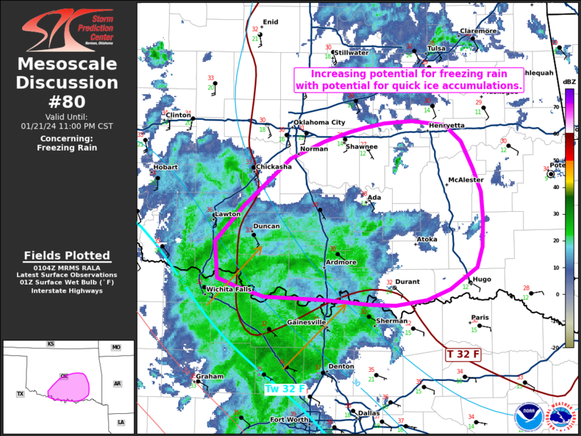
   SUMMARY...Increasing potential for freezing rain with potential for
   quick ice accumulations.

   DISCUSSION...A region of light to moderate precipitation is observed
   moving northeastward into southwestern Oklahoma over the last hour.
   Surface temperatures are hovering around freezing near the Red River
   with a drop into the upper 20s moving northeast. With dew points in
   the teens, further reduction of temperatures through wet-bulb
   cooling can be expected as the heavier precipitation moves
   northward.

   The 00z sounding from OUN shows a pronounced warm nose from 925 mb
   to around 800 mb with surface temperatures below freezing. Though
   some dry air remains around 750 mb and near the surface, the profile
   has moistened. It is noteworthy that hi-res guidance is generally
   running a little warm over the last 12-24 hours in trends when
   compared to RTMA. The RAP and HRRR seem to be coming into better
   alignment with current conditions over the last 3-6 hours.
   Expectation is for freezing drizzle and rain to increase in coverage
   over the next few hours across southeastern Oklahoma.  Locations
   that are already below freezing will likely see quick icing,
   especially across elevated surfaces. Given that ground temperatures
   are already below freezing, this will likely impact travel with
   slick conditions developing quickly through the next few hours.

   ..Thornton.. 01/22/2024

   ...Please see www.spc.noaa.gov for graphic product...

   ATTN...WFO...TSA...FWD...OUN...

   LAT...LON   34409839 34739806 35189754 35339717 35429687 35479670
               35509649 35529618 35489581 35339562 35099550 34869540
               34629538 34369540 34169546 33979576 33869601 33819636
               33839667 33869713 33879733 33899783 33989814 34079836
               34409839
|
|
Top/All Mesoscale Discussions/Forecast Products/Home
|
|


