|
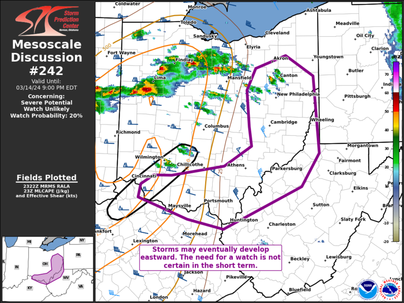
| Mesoscale Discussion 242 |
|
< Previous MD Next MD >
|

|
   Mesoscale Discussion 0242
   NWS Storm Prediction Center Norman OK
   0625 PM CDT Thu Mar 14 2024

   Areas affected...Portions of southern and eastern Ohio into
   northwestern West Virginia

   Concerning...Severe potential...Watch unlikely

   Valid 142325Z - 150100Z

   Probability of Watch Issuance...20 percent

   SUMMARY...Discrete storms have tried to initiate in southwestern
   Ohio into northern Kentucky. Additional organized storms will
   eventually reach the upper Ohio Valley later this evening. The need
   for a watch is quite uncertain in the short term, but convective
   trends will be monitored.

   DISCUSSION...Storms have attempted to initiate in southwestern Ohio
   into northern Kentucky. While it is not clear whether this activity
   will mature, regional VAD profiles suggest that these storms would
   be capable of large hail and tornadoes. Later in the evening, storms
   currently in southern Illinois into central Indiana will likely
   reach the upper Ohio Valley. An airmass supportive of severe storms
   continues to try and work eastward. There is at least some
   possibility that an organized line will reach these areas and
   require a downstream watch. However, uncertainty remains too high to
   issue one at this time. Convective trends will continue to be
   monitored.

   ..Wendt/Hart.. 03/14/2024

   ...Please see www.spc.noaa.gov for graphic product...

   ATTN...WFO...PBZ...RLX...CLE...ILN...

   LAT...LON   38828436 39058430 39198403 39208366 39358254 39698196
               40018202 40608207 40978188 41178122 40838064 39578052
               39018091 38318255 38478332 38828436
|
|
Top/All Mesoscale Discussions/Forecast Products/Home
|
|


