|
| Mesoscale Discussion 386 |
|
< Previous MD Next MD >
|

|
   Mesoscale Discussion 0386
   NWS Storm Prediction Center Norman OK
   0444 PM CDT Mon Apr 08 2024

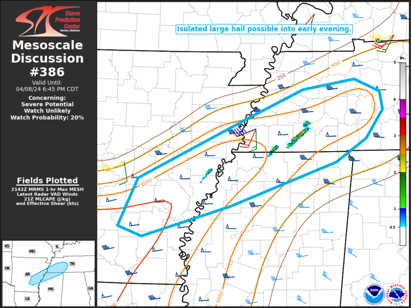
   Areas affected...Southeast AR into northern MS and southwest TN

   Concerning...Severe potential...Watch unlikely

   Valid 082144Z - 082345Z

   Probability of Watch Issuance...20 percent

   SUMMARY...Isolated large hail will remain possible through early
   evening.

   DISCUSSION...Scattered strong storms have developed this afternoon
   along the northern periphery of returning low-level moisture from
   southeast AR into northern MS and southwest TN. Low/mid 60s F
   dewpoints spreading northward into a region where temperatures have
   already warmed well into the 70s F has resulted in MLCAPE rising to
   1000-1500 J/kg. Effective shear of 40-50 kt and elongated hodographs
   will remain supportive of supercell structures, with large hail as
   the primary short-term threat. Coverage of the threat will likely
   remain rather isolated, but one or two cells may be capable of
   producing hail in the 1.5 - 2 inch diameter range, as recently noted
   east of Memphis. Watch issuance is unlikely, unless coverage of
   hail-producing supercells becomes greater than currently
   anticipated.

   ..Dean/Hart.. 04/08/2024

   ...Please see www.spc.noaa.gov for graphic product...

   ATTN...WFO...OHX...HUN...MEG...JAN...LZK...

   LAT...LON   34599199 35489005 35928899 36078804 35898759 35618753
               35198785 34838840 34189033 33729192 33879235 34599199
|
|
Top/All Mesoscale Discussions/Forecast Products/Home
|
|


