|
| Mesoscale Discussion 417 |
|
< Previous MD Next MD >
|

|
   Mesoscale Discussion 0417
   NWS Storm Prediction Center Norman OK
   0635 PM CDT Wed Apr 10 2024

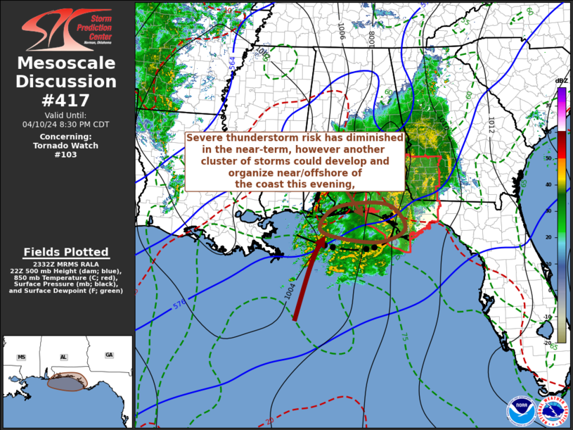
   Areas affected...parts of the Florida Panhandle

   Concerning...Tornado Watch 103...

   Valid 102335Z - 110130Z

   The severe weather threat for Tornado Watch 103 continues.

   SUMMARY...The risk for severe weather has become increasingly
   negligible, at least in the near term, but could increase once again
   later this evening across at least coastal portions of the Florida
   Panhandle around Apalachicola.  While the remainder of Tornado Watch
   103 may be allowed to expire at 9 PM EDT, trends will need to
   continue to be monitored for the possibility of a new severe weather
   watch later this evening.

   DISCUSSION...The initially strong and better organized cluster of
   storms has undergone considerable further weakening as it continues
   to progress through an environment characterized by stable
   near-surface lapse rates and less unstable low-level inflow across
   and inland of northeastern Gulf coastal areas.  Outflow, trailing
   the forward propagating portion of the remnant convective system now
   progressing into the Apalachicola vicinity, has advanced 60-70 miles
   offshore of the western Florida Panhandle, but appears to have
   stalled in advance of a significant mid-level short wave still west
   of the lower Mississippi Valley.

   Renewed thunderstorm development is ongoing along and southwest of
   the stalling portion of the outflow, aided by forcing associated
   with strengthening low-level warm advection beneath increasingly
   difluent upper flow.  It appears that this may increasingly acquire
   low-level inflow of moderately unstable air over the next few hours,
   with potential for further upscale growth and the evolution of
   another organizing convective convective cluster along the outflow
   boundary through mid/late evening.  While the bulk of the strongest
   storms may remain offshore, it is possible that the risk for severe
   storms could increase again across coastal areas around Apalachicola
   later this evening.

   ..Kerr.. 04/10/2024

   ...Please see www.spc.noaa.gov for graphic product...

   ATTN...WFO...TAE...MOB...

   LAT...LON   30448747 30648657 30558558 29918513 29558590 29648715
               29908786 30448747
|
|
Top/All Mesoscale Discussions/Forecast Products/Home
|
|


