|
| Mesoscale Discussion 716 |
|
< Previous MD Next MD >
|

|
   Mesoscale Discussion 0716
   NWS Storm Prediction Center Norman OK
   0729 PM CDT Wed May 08 2024

   Areas affected...central and northern Arkansas...and western/Middle
   Tennessee

   Concerning...Severe potential...Tornado Watch likely

   Valid 090029Z - 090130Z

   Probability of Watch Issuance...95 percent

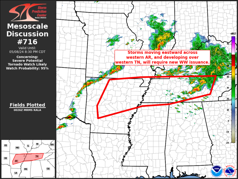
   SUMMARY...A band of severe/rotating storms from the Ozarks to far
   eastern Oklahoma, and developing convection across the western
   Tennessee area in soon-to-expire WW 209, will require new Tornado
   Watch issuance.

   DISCUSSION...Latest Springfield, MO (KSGF) radar loop shows a band
   of severe/supercell storms moving across south-central Missouri and
   northwestern Arkansas.  Meanwhile, convection is gradually
   increasing farther east, across western Tennessee.

   The airmass across this region remains very unstable, with
   mixed-layer CAPE in the 3000 to 4000 J/kg range.  This should be
   more than sufficient to sustain vigorous updrafts, support CAM runs
   which increase convective coverage over the next several hours.
   Strong deep-layer winds will support organized convection, with an
   all-hazards severe risk likely to continue through the evening and
   into the overnight hours -- warranting new tornado watch issuance
   across this region.

   ..Goss/Hart.. 05/09/2024

   ...Please see www.spc.noaa.gov for graphic product...

   ATTN...WFO...MRX...OHX...HUN...PAH...MEG...LZK...SGF...SHV...

   LAT...LON   36399273 36599029 36568440 35438492 34898810 34779015
               33939349 34739361 36399273
|
|
Top/All Mesoscale Discussions/Forecast Products/Home
|
|


