|
| Mesoscale Discussion 759 |
|
< Previous MD Next MD >
|

|
   Mesoscale Discussion 0759
   NWS Storm Prediction Center Norman OK
   0204 PM CDT Sun May 12 2024

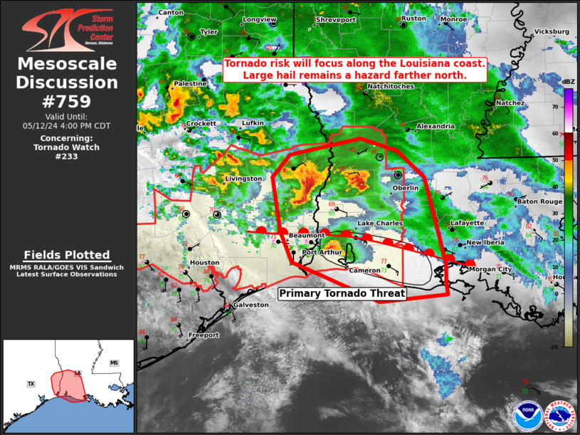
   Areas affected...Far East Texas and Southwest Louisiana

   Concerning...Tornado Watch 233...

   Valid 121904Z - 122100Z

   The severe weather threat for Tornado Watch 233 continues.

   SUMMARY...Large to hail to 2 inches will be possible with storms in
   WW 233. The tornado risk will focus along the Louisiana coast as a
   storm tracks along and just south of the warm front.

   DISCUSSION...Storms north of the warm front will continue to pose
   primarily a threat for large hail up to 2 inches as these storms
   will remain elevated. Farther south, a storm in far southwest
   Louisiana has produced 2 inch hail and a 49 kt wind gust in the
   Beaumont, TX vicinity. This storm, which appears to be along or just
   south of the warm front, will also pose the greatest risk for a
   tornado over the next 1-2 hours. This storm has shown varying
   degrees of low-level organization over the past hour.

   ..Wendt.. 05/12/2024

   ...Please see www.spc.noaa.gov for graphic product...

   ATTN...WFO...LCH...

   LAT...LON   29849403 30189418 30799429 31049408 31069400 31229316
               31089267 30789232 29829205 29609206 29489204 29399290
               29699366 29849403
|
|
Top/All Mesoscale Discussions/Forecast Products/Home
|
|


