|
| Mesoscale Discussion 898 |
|
< Previous MD Next MD >
|
|
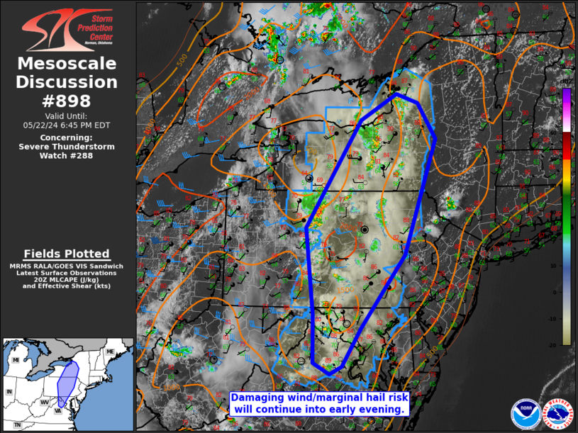
   Mesoscale Discussion 0898
   NWS Storm Prediction Center Norman OK
   0339 PM CDT Wed May 22 2024

   Areas affected...Portions of northern Mid-Atlantic

   Concerning...Severe Thunderstorm Watch 288...

   Valid 222039Z - 222245Z

   The severe weather threat for Severe Thunderstorm Watch 288
   continues.

   SUMMARY...Damaging wind gusts and marginally severe hail will remain
   possible into the early evening.

   DISCUSSION...The most organized convection has been within central
   New York into north-central Pennsylvania, more closely associated
   with the MCV. Occasional wind damage has been reported with some of
   this activity. Farther south into the Blue Ridge, storms developed
   with a moist/unstable airmass, but have not appeared overly
   organized given around 25 kts of effective shear (observed on 18Z
   IAD sounding and supported by current mesoanalysis). Should
   clustering occur east of the Blue Ridge, some locally greater risk
   for wind damage would be possible. The overall hail threat should
   remain rather low given weak upper-level winds, but small to
   marginally severe hail could occur with the strongest storms. Drier
   air to the east has led to weaker buoyancy. Storms are expected to
   gradually weaken as they move east into the early evening.

   ..Wendt.. 05/22/2024

   ...Please see www.spc.noaa.gov for graphic product...

   ATTN...WFO...ALY...PHI...BGM...BUF...CTP...LWX...

   LAT...LON   41287842 43377700 43897606 43717551 43007504 40747588
               39327700 38577749 38417780 38647822 39587822 41287842
|
|
Top/All Mesoscale Discussions/Forecast Products/Home
|
|


 @NWSSPC