|
| Mesoscale Discussion 965 |
|
< Previous MD Next MD >
|
|
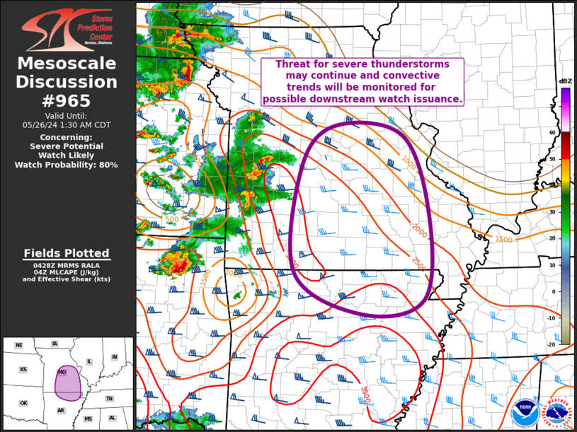
   Mesoscale Discussion 0965
   NWS Storm Prediction Center Norman OK
   1131 PM CDT Sat May 25 2024

   Areas affected...Central/Eastern MO...Far North-Central/Northeast AR

   Concerning...Severe potential...Watch likely

   Valid 260431Z - 260630Z

   Probability of Watch Issuance...80 percent

   SUMMARY...Threat for severe thunderstorms may continue into central
   and eastern Missouri and north-central Arkansas, and convective
   trends will be monitored for potential downstream watch issuance.

   DISCUSSION...Broad area of showers and embedded thunderstorms
   continues to progress eastward across northeast OK, eastern KS and
   western MO, supported by warm-air advection and modest ascent ahead
   of a shortwave trough over the central Plains. With the exception of
   the well-organized supercell moving through Rogers County OK, most
   of this activity has remained elevated and relatively disorganized.
   Even so, a downdraft associated with an initially elevated cell
   recently produced gusts from 50 to 60 kt at it moved through far
   northeast KS. A few updrafts have also pulsed up to severe
   thresholds. This general trend is expected to continue eastward,
   with the overall environment remaining supportive of sporadic large
   hail and/or damaging gusts, particularly over
   south-central/southeast MO and north-central AR where buoyancy will
   be greatest. Convective trends will be monitored for a potential
   watch downstream.

   ..Mosier/Smith.. 05/26/2024

   ...Please see www.spc.noaa.gov for graphic product...

   ATTN...WFO...PAH...MEG...LSX...LZK...SGF...

   LAT...LON   38219303 38939233 38779089 37439034 36009045 35749171
               36439315 38219303
|
|
Top/All Mesoscale Discussions/Forecast Products/Home
|
|


 @NWSSPC