|
| Mesoscale Discussion 1004 |
|
< Previous MD Next MD >
|

|
   Mesoscale Discussion 1004
   NWS Storm Prediction Center Norman OK
   0939 PM CDT Sun May 26 2024

   Areas affected...Western/Middle TN

   Concerning...Severe potential...Tornado Watch likely

   Valid 270239Z - 270415Z

   Probability of Watch Issuance...95 percent

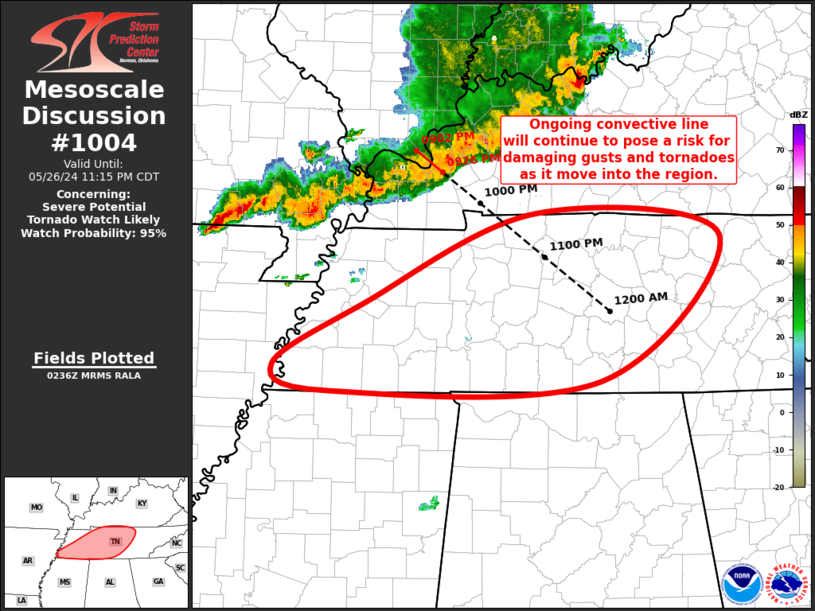
   SUMMARY...Ongoing convective line will continue to pose a risk for
   damaging gusts and tornadoes as it moves into TN, and a Tornado
   Watch will be issued soon.

   DISCUSSION...Ongoing convective line continues to push southeastward
   across western KY and the MO Bootheel. Portion of this line moving
   across far southwest KY is moving at around 45 kt, which will bring
   it to the south-central KY/middle TN around 0300Z. Strong buoyancy
   and shear already in place suggest the line will maintain its
   intensity as it continues southeastward into the region. Damaging
   gusts will be the primary risk, but the strong low-level veering
   with height sampled by the 00Z BNA sounding and recent OHX VAD
   suggests some QLCS tornado potential as well, particularly with the
   central portions of the line which could be oriented more orthogonal
   to the deep-layer flow. Given the anticipated threat, a Tornado
   Watch is being issued.

   ..Mosier/Smith.. 05/27/2024

   ...Please see www.spc.noaa.gov for graphic product...

   ATTN...WFO...OHX...HUN...PAH...MEG...

   LAT...LON   35808918 36658724 36448514 35108649 35008955 35239021
               35808918
|
|
Top/All Mesoscale Discussions/Forecast Products/Home
|
|


