|
| Mesoscale Discussion 1009 |
|
< Previous MD Next MD >
|

|
   Mesoscale Discussion 1009
   NWS Storm Prediction Center Norman OK
   0205 AM CDT Mon May 27 2024

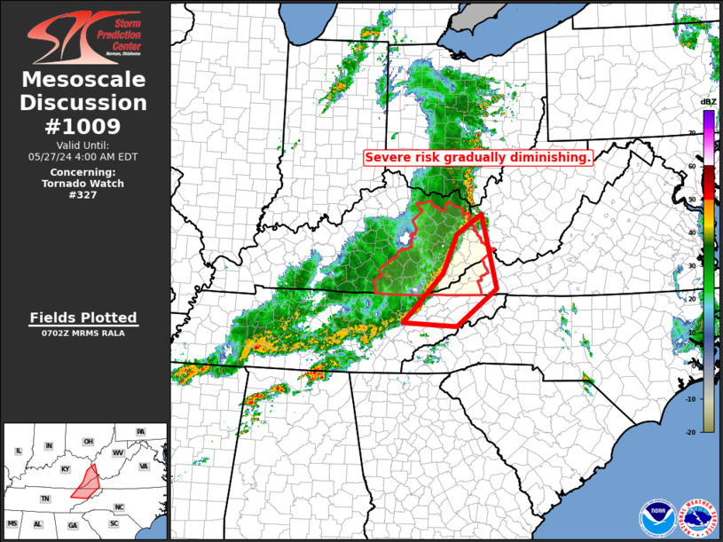
   Areas affected...eastern Kentucky...far western Virginia and
   vicinity

   Concerning...Tornado Watch 327...

   Valid 270705Z - 270800Z

   The severe weather threat for Tornado Watch 327 continues.

   SUMMARY...Severe risk is gradually diminishing across WW 327.

   DISCUSSION...Latest radar loop shows a continuous -- but gradually
   weakening -- line of storms extending from south-central Ohio to
   northwestern Tennessee.  The convection has gradually been
   weakening, as it encounters an increasingly stable low-level
   environment with eastward extent.  Measured gusts across eastern
   Kentucky have been well below severe levels over the past couple of
   hours per mesonet observations, and expect this trend to continue as
   storms move eastward over the next couple of hours.

   ..Goss.. 05/27/2024

   ...Please see www.spc.noaa.gov for graphic product...

   ATTN...WFO...RLX...MRX...JKL...

   LAT...LON   38248229 36728191 35958293 36028428 37048328 37828294
               38248229
|
|
Top/All Mesoscale Discussions/Forecast Products/Home
|
|


