|
| Mesoscale Discussion 1075 |
|
< Previous MD Next MD >
|
|
Mesoscale Discussion 1075
NWS Storm Prediction Center Norman OK
0500 AM CDT Thu May 30 2024
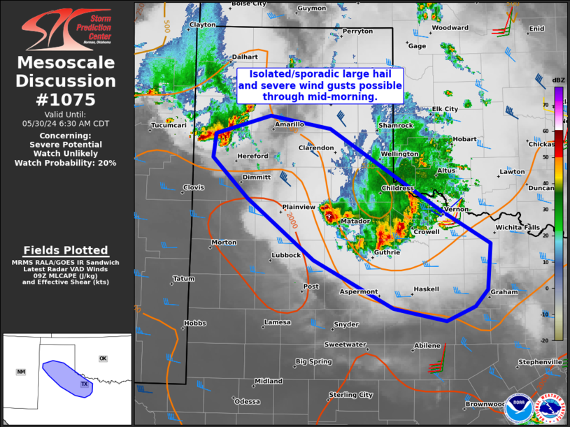
Areas affected...Western TX Panhandle to western north TX
Concerning...Severe potential...Watch unlikely
Valid 301000Z - 301130Z
Probability of Watch Issuance...20 percent
SUMMARY...Sporadic and isolated large hail/severe wind gusts will
remain possible through mid-morning with regenerative thunderstorm
clusters.
DISCUSSION...Persistent warm theta-e advection, supported by a 40-45
kt low-level jet and characterized by low to mid 60s surface dew
points spreading north into the TX Panhandle, continues to foster
regenerative updrafts that are capable of producing large hail and
localized severe gusts. Recent HRRR runs along with the 00Z
NSSL-MPAS suggest two distinct clusters will continue east-southeast
through mid-morning. The leading one will spread deeper into western
north TX, with the primary large hail threat occurring along its
western/upstream flank. The second one in the western TX Panhandle
will likely track along the residual outflow from the leading
cluster. The low-level jet should finally subside after sunrise
which will probably marginalize the overall severe threat briefly,
before downstream boundary-layer warming aids in possible
restrengthening in the late morning.
..Grams/Thompson.. 05/30/2024
...Please see www.spc.noaa.gov for graphic product...
ATTN...WFO...FWD...OUN...SJT...LUB...AMA...
LAT...LON 34219931 33779854 33199859 32989878 32809921 32970000
33570121 34350220 34860273 35150269 35380187 35220096
34219931
|
|
Top/All Mesoscale Discussions/Forecast Products/Home
|
|


 @NWSSPC