|
| Mesoscale Discussion 1077 |
|
< Previous MD Next MD >
|
|
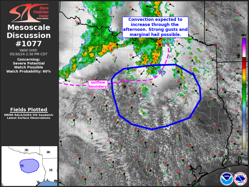
   Mesoscale Discussion 1077
   NWS Storm Prediction Center Norman OK
   1224 PM CDT Thu May 30 2024

   Areas affected...portions of north/east TX

   Concerning...Severe potential...Watch possible

   Valid 301724Z - 301930Z

   Probability of Watch Issuance...60 percent

   SUMMARY...Thunderstorms will increase in coverage/intensity through
   the afternoon. Strong gusts to 50-65 mph are possible, along with
   isolated large hail.

   DISCUSSION...Thunderstorms are beginning to develop early this
   afternoon across north into northeast TX to the south and and east
   of an outflow boundary and ongoing line of storms near the Red
   River. This activity is developing in a very moist airmass (low to
   mid 70s F dewpoints). Strong heating into the 80s and midlevel lapse
   rates near 7-7.5 C/km are contributing to strong instability
   (2000-3000 J/kg). This will support robust updrafts, however,
   vertical shear is expected to be somewhat modest with eastward
   extent across northeast TX. As a result, stronger updrafts may be
   transient and overall storm organization more messy. Nevertheless,
   isolated gusts in the 50-65 mph range appear possible, along with a
   few instances of large hail. If thunderstorm clusters can organize
   via consolidating outflow/cold pool generation, a line of storms may
   develop and shift east/southeast. If this occurs, damaging wind
   potential will increase. However, this scenario remains uncertain.
   Trends are being monitored for possible watch issuance within the
   next couple of hours.

   ..Leitman/Guyer.. 05/30/2024

   ...Please see www.spc.noaa.gov for graphic product...

   ATTN...WFO...SHV...HGX...FWD...

   LAT...LON   31039591 30929647 31099719 31369767 32079791 32499797
               32659782 32829753 32959647 32969558 32649491 32249468
               31879467 31289509 31039591
|
|
Top/All Mesoscale Discussions/Forecast Products/Home
|
|


 @NWSSPC