|
| Mesoscale Discussion 1127 |
|
< Previous MD Next MD >
|
|
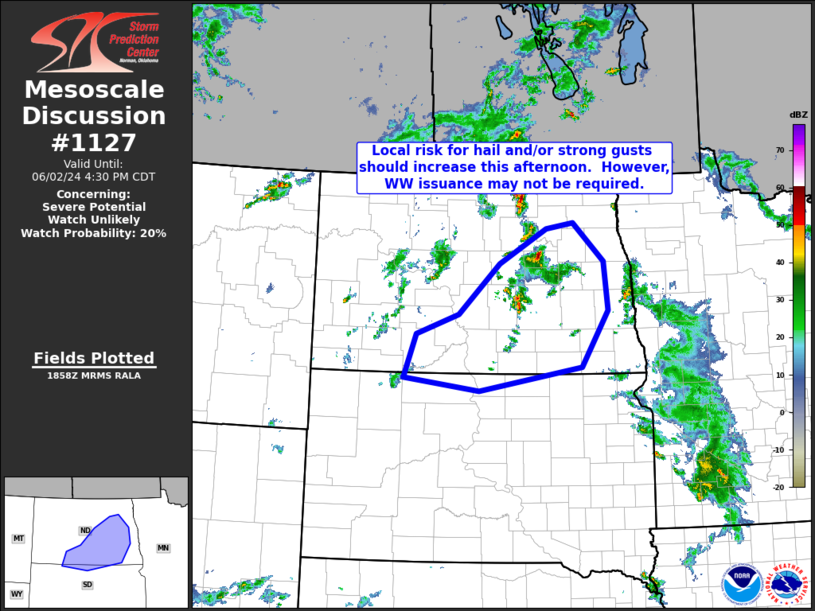
   Mesoscale Discussion 1127
   NWS Storm Prediction Center Norman OK
   0201 PM CDT Sun Jun 02 2024

   Areas affected...portions of central North Dakota into far northern
   South Dakota

   Concerning...Severe potential...Watch unlikely

   Valid 021901Z - 022130Z

   Probability of Watch Issuance...20 percent

   SUMMARY...Widely scattered thunderstorms will continue to develop
   across portions of North Dakota this afternoon. A few stronger
   storms will be accompanied by marginal hail/wind risk, but at this
   time WW issuance appears likely to remain unnecessary.

   DISCUSSION...Latest visible satellite loop shows convection
   developing southward across south-central North Dakota, south of an
   initial, strong storm now crossing Eddy County.  Meanwhile, some
   increase in cumulus development is evident southwestward into
   northwestern South Dakota, along a weak cool front.

   Mixed-layer CAPE currently ranges from around 500 J/kg (northeastern
   North Dakota) to 1500 to 2000 J/kg southwestward into northwestern
   South Dakota.  This -- combined with modest shear (moderate/roughly
   unidirectional southwesterly flow in the lower and middle
   troposphere) suggests a few stronger multicell-type storms can be
   expected this afternoon, potentially clustering into a larger MCS
   this evening as storms shift eastward toward Minnesota.  Overall
   severe risk should remain limited however, potentially precluding
   the need for WW issuance.

   ..Goss/Smith.. 06/02/2024

   ...Please see www.spc.noaa.gov for graphic product...

   ATTN...WFO...FGF...ABR...BIS...

   LAT...LON   46540170 46850076 47659983 48199877 48279816 47689747
               46919738 46039798 45670028 45870197 46540170
|
|
Top/All Mesoscale Discussions/Forecast Products/Home
|
|


 @NWSSPC