|
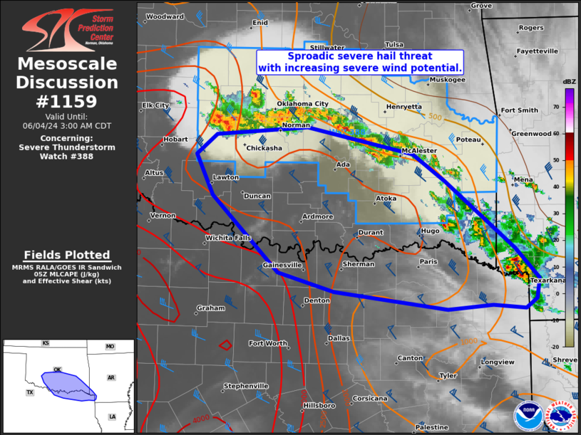
| Mesoscale Discussion 1159 |
|
< Previous MD Next MD >
|

|
   Mesoscale Discussion 1159
   NWS Storm Prediction Center Norman OK
   0100 AM CDT Tue Jun 04 2024

   Areas affected...Central OK to the Red River Valley

   Concerning...Severe Thunderstorm Watch 388...

   Valid 040600Z - 040800Z

   The severe weather threat for Severe Thunderstorm Watch 388
   continues.

   SUMMARY...Initial severe hail threat will probably transition to
   mainly a severe wind threat in the pre-dawn hours. An additional
   severe thunderstorm watch and/or expansion of WW 388 to the Red
   River may be needed in the next couple hours.

   DISCUSSION...Elevated thunderstorms have blossomed over the past
   hour with parcels rooted from 900-800 mb within the exit region of a
   mid 40s southerly low-level jet as sampled by the FWS VWP. Despite
   ample ML/MUCAPE emanating north from central TX to southwest OK, the
   increasingly predominant cluster mode coupled with weak shear above
   500 mb per the TLX VWP and forecast soundings suggest that the hail
   threat will probably remain tempered in the 1-1.75 inch diameter
   range. Available 00Z NSSL-MPAS runs are consistent with a few of the
   00Z HREF members in indicating upscale growth with convection
   accelerating southward to the Red River along and east of the I-35
   corridor. As this process occurs, potential for wind gusts from
   55-70 mph will increase.

   ..Grams/Thompson.. 06/04/2024

   ...Please see www.spc.noaa.gov for graphic product...

   ATTN...WFO...SHV...TSA...FWD...OUN...

   LAT...LON   35169834 35259707 34959562 34639518 33859422 33519389
               33279393 33169407 33219452 33169514 33369670 33589747
               34469838 34939862 35169834
|
|
Top/All Mesoscale Discussions/Forecast Products/Home
|
|


