|
| Mesoscale Discussion 1214 |
|
< Previous MD Next MD >
|
|
Mesoscale Discussion 1214
NWS Storm Prediction Center Norman OK
0251 AM CDT Sun Jun 09 2024
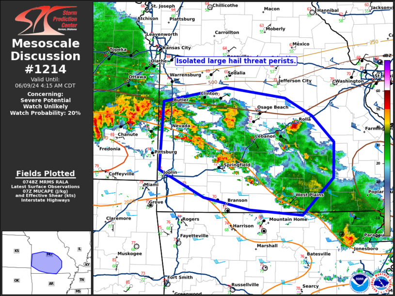
Areas affected...southwest Missouri
Concerning...Severe potential...Watch unlikely
Valid 090751Z - 090915Z
Probability of Watch Issuance...20 percent
SUMMARY...An isolated large hail threat will persist this morning.
DISCUSSION...Thunderstorms with occasional supercellular
characteristics have developed across southwest Missouri in a region
of weak isentropic ascent and moderate instability. The primary
threat will be isolated large hail, with that threat persisting
through the early morning hours.
The long-lived, severe-wind producing MCS across western Kansas is
not anticipated to reach southwest Missouri, at least not with
substantial severe potential, given the increasing inhibition and
widespread stabilizing convection ahead of the remaining line.
Therefore, an isolated large hail threat may persist and necessitate
a watch extension for a few more hours. However, an additional watch
for storms moving out of Kansas is unlikely, for the aforementioned
reasons.
..Bentley/Hart.. 06/09/2024
...Please see www.spc.noaa.gov for graphic product...
ATTN...WFO...PAH...LSX...LZK...SGF...EAX...
LAT...LON 38299451 38519323 38359203 38059147 37629104 37049105
36449168 36539275 36749368 37179457 38299451
|
|
Top/All Mesoscale Discussions/Forecast Products/Home
|
|


 @NWSSPC