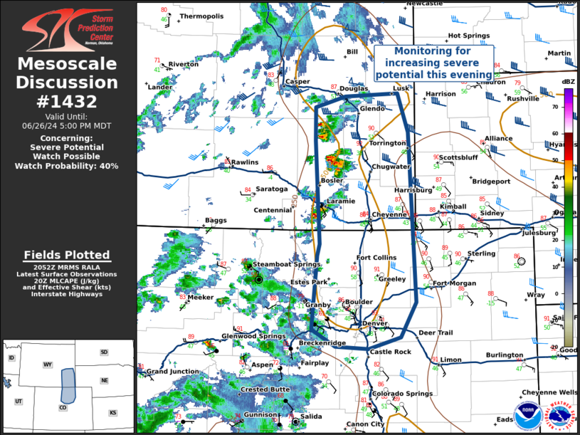
   Mesoscale Discussion 1432
   NWS Storm Prediction Center Norman OK
   0353 PM CDT Wed Jun 26 2024

   Areas affected...Portions of Northern Colorado into Southeast
   Wyoming

   Concerning...Severe potential...Watch possible

   Valid 262053Z - 262300Z

   Probability of Watch Issuance...40 percent

   SUMMARY...Thunderstorms have begun developing west of Cheyenne, WY,
   with additional development possible near the Denver metro where
   visible satellite shows additional cumulus development. These
   thunderstorms will be capable of damaging winds and hail, but
   overall uncertainty in storm organization, coverage, and timing
   means convective trends will continue to be monitored for weather
   watch issuance.

   DISCUSSION...Thunderstorm development has increased over Cheyenne
   and is anticipated to continue eastward into relatively meager
   buoyancy of 500-1000 J/kg MLCAPE, and 40-45 kts of deep layer shear.
   Further south, developing cumulus was observed west of Denver over
   the Rockies, with convective coverage expected to increase this
   evening ahead of a subtle shortwave trough moving around the north
   side of the upper level high.

   RAP proximity soundings and SPC mesoanalysis show the environment is
   characterized by MLLCL heights > 2500m due to a relatively hot, dry
   boundary layer, indicating the primary threat will be for damaging
   straight-line winds from thunderstorm outflow. Given the strength of
   the vertical shear, severe hail is also possible with more organized
   storms.

   However, there is considerable uncertainty in the overall timing,
   coverage, and organization of severe convection this evening, and
   convective trends will continue to be monitored for later weather
   watch issuance.

   ..Halbert/Weinman/Hart.. 06/26/2024

   ...Please see www.spc.noaa.gov for graphic product...

   ATTN...WFO...BOU...CYS...

   LAT...LON   42750435 42260416 40070405 39620430 39460485 39490541
               39720580 40660571 40810568 42140575 42570576 42710524
               42750435
|


 @NWSSPC