|
| Mesoscale Discussion 1564 |
|
< Previous MD Next MD >
|
|
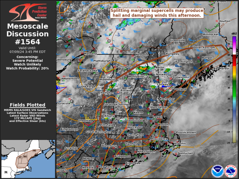
   Mesoscale Discussion 1564
   NWS Storm Prediction Center Norman OK
   1245 PM CDT Tue Jul 09 2024

   Areas affected...Portions of New England

   Concerning...Severe potential...Watch unlikely

   Valid 091745Z - 091945Z

   Probability of Watch Issuance...20 percent

   SUMMARY...Splitting marginal supercells will be capable of isolated
   large hail and damaging winds this afternoon. A watch is not
   expected.

   DISCUSSION...Ahead of a low amplitude mid-level shortwave trough,
   convection has been gradually deepening in New England as
   temperatures have risen into low to mid 80s F. While severe surface
   observations are showing low 70s F dewpoints, some mixing is
   expected and dewpoints will likely setting into the upper 60S F.
   Lapse rates aloft are quite weak, but the moist airmass will support
   500 to perhaps around 1000 J/kg MLCAPE later this afternoon.
   Hodographs are generally long and straight, though modest low-level
   curvature is evident on the KGYX VAD. The wind profile will support
   splitting supercells, though the weak lapse rates aloft should
   moderate storm intensity. The overall thinking is that as storms
   gradually intensify they will be capable of large hail (1-1.5 in.)
   and isolated damaging winds (45-60 mph). Per the KGYX VAD, low-level
   shear is enough to support weak low-level rotation in the strongest
   storms, but the tornado threat is still expected to be very low.

   ..Wendt/Guyer.. 07/09/2024

   ...Please see www.spc.noaa.gov for graphic product...

   ATTN...WFO...CAR...GYX...BOX...BTV...ALY...

   LAT...LON   42577395 43857372 44637200 45226953 45316770 45036737
               44486866 43397059 42447097 41917157 41807308 41897357
               42577395
|
|
Top/All Mesoscale Discussions/Forecast Products/Home
|
|


 @NWSSPC