|
| Mesoscale Discussion 1591 |
|
< Previous MD Next MD >
|

|
   Mesoscale Discussion 1591
   NWS Storm Prediction Center Norman OK
   1120 PM CDT Fri Jul 12 2024

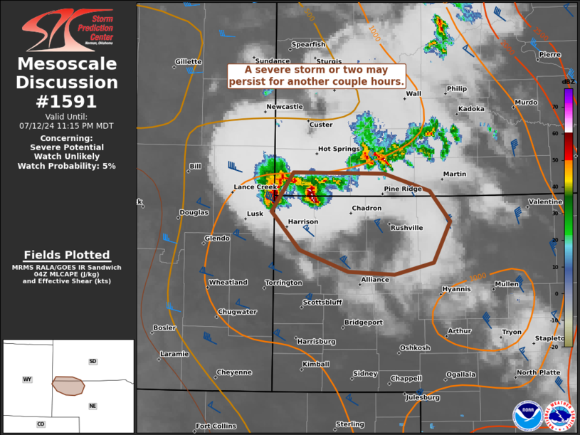
   Areas affected...the northwest NE Panhandle and far southwest SD

   Concerning...Severe potential...Watch unlikely

   Valid 130420Z - 130515Z

   Probability of Watch Issuance...5 percent

   SUMMARY...A pair of strong to marginally severe storms may persist
   through about 06Z, but an overall weakening trend is expected
   overnight.

   DISCUSSION...A couple of more robust storms are ongoing near the
   WY/SD/NE border area to the west-southwest of a weakening cluster
   over southwest SD. This activity appears to be supported by stronger
   effective bulk shear despite ever-increasing MLCIN and displacement
   from greater low-level moisture across central to southern NE. A
   branch of the southerly low-level jet as sampled by the GLD VWP
   appears to further aiding these storms that are capable of producing
   isolated severe hail and wind. Evening CAM guidance is insistent on
   this activity decaying rapidly overnight as this lobe of the
   low-level jet weakens, while the TX/OK Panhandles to central KS
   branch dominates during the early morning.

   ..Grams/Gleason.. 07/13/2024

   ...Please see www.spc.noaa.gov for graphic product...

   ATTN...WFO...LBF...UNR...CYS...

   LAT...LON   43230379 43220252 43050190 42730162 42320184 42190238
               42230302 42440370 42830409 43230379
|
|
Top/All Mesoscale Discussions/Forecast Products/Home
|
|


