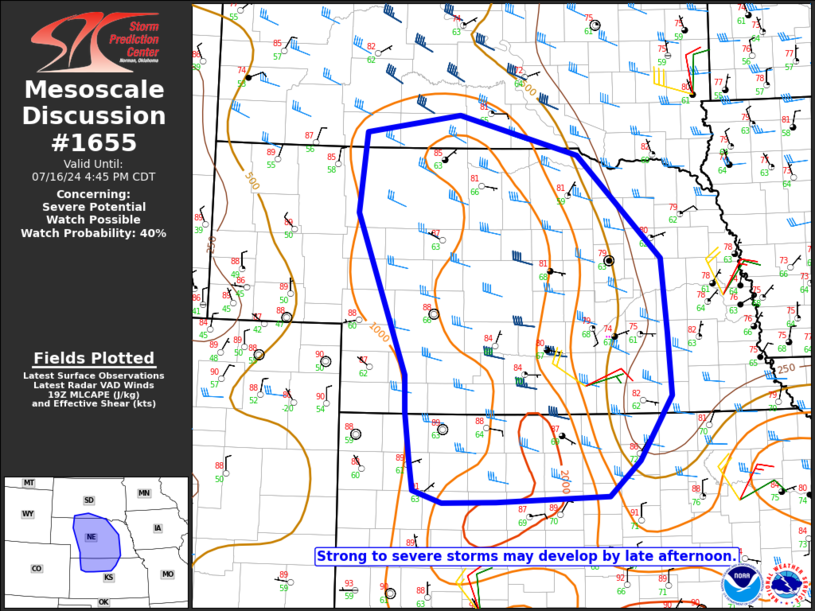
   Mesoscale Discussion 1655
   NWS Storm Prediction Center Norman OK
   0240 PM CDT Tue Jul 16 2024

   Areas affected...Central NE into parts of north-central KS and
   south-central SD

   Concerning...Severe potential...Watch possible

   Valid 161940Z - 162145Z

   Probability of Watch Issuance...40 percent

   SUMMARY...Strong to severe storms may develop by late afternoon.

   DISCUSSION...Cumulus is deepening this afternoon across parts of
   south-central NE, with some building cumulus also noted into
   northwest NE and extreme south-central SD. The building cumulus is
   ongoing within a region of relatively rich low-level moisture, with
   diurnal heating supporting MLCAPE of near/above 1500 J/kg and
   weakening MLCINH. In the absence of stronger large-scale ascent,
   details regarding storm coverage and timing of more robust storm
   development remain uncertain. However, storm initiation is underway
   across south-central NE, with at least isolated development possible
   farther north, within a zone of modest low-level confluence near a
   weak surface low across central NE.

   Low-level flow is weak, but modest midlevel west-northwesterlies are
   supporting effective shear of 30-40 kt, and it is possible that a
   couple of supercells and/or stronger storm clusters could develop by
   late afternoon into the early evening. Midlevel lapse rates are
   generally rather weak, but some hail threat could accompany any
   sustained supercells, along with a threat of localized severe gusts.
   Watch issuance is possible for parts of the area later this
   afternoon, if development of multiple severe storms appears
   imminent.

   ..Dean/Hart.. 07/16/2024

   ...Please see www.spc.noaa.gov for graphic product...

   ATTN...WFO...FSD...OAX...TOP...ICT...GID...LBF...DDC...UNR...
   GLD...

   LAT...LON   43360030 42929853 41749728 40919720 40199716 39469763
               39079809 39019974 38990054 39130096 39460102 40020109
               40430109 42250183 43170172 43360030
|


 @NWSSPC