|
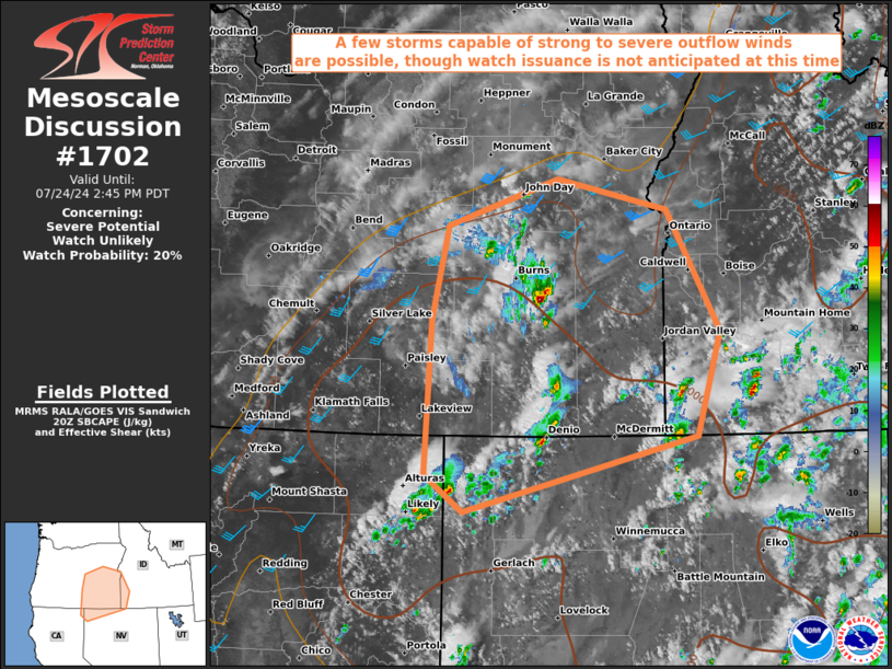
| Mesoscale Discussion 1702 |
|
< Previous MD Next MD >
|

|
   Mesoscale Discussion 1702
   NWS Storm Prediction Center Norman OK
   0338 PM CDT Wed Jul 24 2024

   Areas affected...Southeast Oregon...Southwest Idaho...far Northeast
   California...and far Northwest Nevada

   Concerning...Severe potential...Watch unlikely

   Valid 242038Z - 242145Z

   Probability of Watch Issuance...20 percent

   SUMMARY...A few storms capable of strong to severe outflow winds are
   possible, though watch issuance is not anticipated at this time.

   DISCUSSION...Regional radar/satellite shows isolated convective
   development beginning to occur across the region amid strong surface
   heating (temperatures in the mid 90s to near 100 F) and sufficient
   low-level moisture (dew point temperatures in the upper 40s to mid
   50s F), yielding SBCAPE approaching 1500 J/kg with strong low-level
   lapse rates (exceeding 10 C/km). Additionally, broad forcing for
   ascent associated with a mid-level trough traversing the region is
   aiding is destabilization and erosion of convective inhibition. As
   the relatively stronger flow associated with the trough overspreads
   the region, effective bulk shear should continue to increase near
   30-35 kt.

   Given the aforementioned environment and trends, storms are expected
   to continue expanding in coverage while exhibiting at least
   transient organization. Gusty outflow winds exceeding severe limits
   will be the main threat with these storms. Presently, severe storm
   coverage is anticipated to remain transient and sparse, precluding
   the need for a watch at this time. However, convective trends will
   continue to be monitored into the evening.

   ..Karstens/Thompson.. 07/24/2024

   ...Please see www.spc.noaa.gov for graphic product...

   ATTN...WFO...BOI...LKN...PDT...REV...MFR...

   LAT...LON   41981658 41231974 41602026 43162018 44101997 44571846
               44261698 43031626 41981658
|
|
Top/All Mesoscale Discussions/Forecast Products/Home
|
|


