|
| Mesoscale Discussion 2254 |
|
< Previous MD Next MD >
|

|
   Mesoscale Discussion 2254
   NWS Storm Prediction Center Norman OK
   0223 PM CST Mon Dec 09 2024

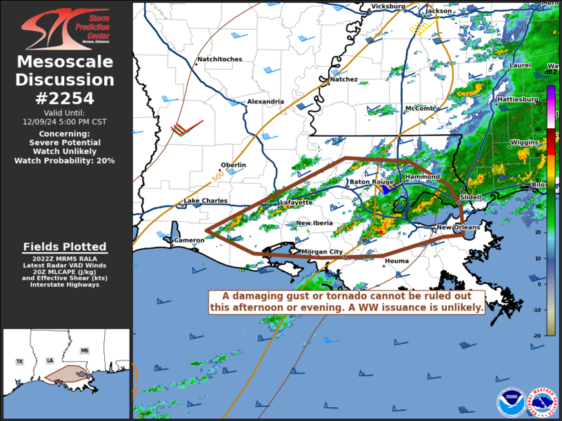
   Areas affected...portions of central into eastern Louisiana

   Concerning...Severe potential...Watch unlikely

   Valid 092023Z - 092300Z

   Probability of Watch Issuance...20 percent

   SUMMARY...A isolated damaging gust or tornado cannot be ruled out
   this afternoon and early evening. The severe threat should remain
   sparse and a WW issuance is not expected.

   DISCUSSION...Thunderstorms have gradually been intensifying along a
   confluence band across portions of southern LA, where a 925-850 mb
   moisture axis preceding an approaching low-level trough is in place.
   A west-southwesterly 500 mb wind maxima is overspreading the region,
   contributing to elongated but mainly straight hodographs (per the
   latest HDC VAD) and corresponding 60+ kts of effective bulk shear
   (most of which should be speed based). This shear, along with
   diurnal heating contributing up to 500 J/kg MLCAPE, will favor some
   organization of convective elements within the aforementioned
   precipitation band. Transient supercell modes are possible. 30 kts
   of southwesterly 850 mb flow is also approaching from the west, and
   this may contribute to some additional curvature to the low-level
   hodograph and subsequent increase in low-level shear. As such, a
   damaging wind gust or tornado cannot be ruled out this afternoon in
   the evening. However, the overall severe threat should remain
   isolated, and a WW issuance is not anticipated.

   ..Squitieri/Hart.. 12/09/2024

   ...Please see www.spc.noaa.gov for graphic product...

   ATTN...WFO...LIX...LCH...

   LAT...LON   29959290 30769119 30719039 30468989 30218975 29918973
               29908998 29709072 29689147 29719231 29959290
|
|
Top/All Mesoscale Discussions/Forecast Products/Home
|
|


