|
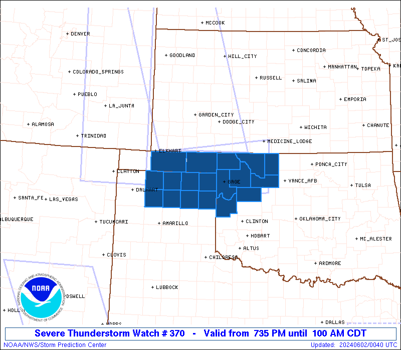
Initial List of Counties in SPC Severe Thunderstorm Watch 370 (WOU)
|
Back to Watch 370
|
 |
   WOUS64 KWNS 020033
   WOU0

   BULLETIN - IMMEDIATE BROADCAST REQUESTED
   SEVERE THUNDERSTORM WATCH OUTLINE UPDATE FOR WS 370
   NWS STORM PREDICTION CENTER NORMAN OK
   735 PM CDT SAT JUN 1 2024

   SEVERE THUNDERSTORM WATCH 370 IS IN EFFECT UNTIL 100 AM CDT
   FOR THE FOLLOWING LOCATIONS

   OKC003-007-043-045-059-093-129-139-151-153-020600-
   /O.NEW.KWNS.SV.A.0370.240602T0035Z-240602T0600Z/

   OK
   .    OKLAHOMA COUNTIES INCLUDED ARE

   ALFALFA              BEAVER              DEWEY
   ELLIS                HARPER              MAJOR
   ROGER MILLS          TEXAS               WOODS
   WOODWARD


   TXC195-211-233-295-341-357-393-421-020600-
   /O.NEW.KWNS.SV.A.0370.240602T0035Z-240602T0600Z/

   TX
   .    TEXAS COUNTIES INCLUDED ARE

   HANSFORD             HEMPHILL            HUTCHINSON
   LIPSCOMB             MOORE               OCHILTREE
   ROBERTS              SHERMAN


   ATTN...WFO...OUN...AMA...
|
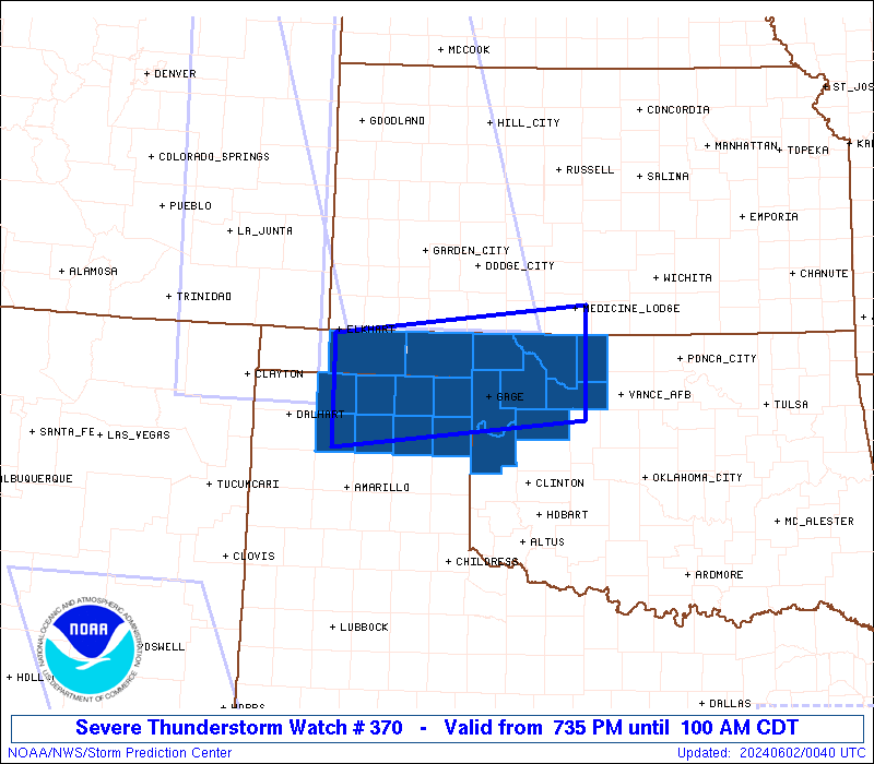
| Aviation Watch (SAW) for WW370 |
|---|
 |
| Note:
The Aviation Watch (SAW) product is an approximation to the watch area.
The actual watch is depicted by the shaded areas. |
   SAW0
   WW 370 SEVERE TSTM OK TX 020035Z - 020600Z
   AXIS..45 STATUTE MILES NORTH AND SOUTH OF LINE..
   35SW GUY/GUYMON OK/ - 15ESE AVK/ALVA OK/
   ..AVIATION COORDS.. 40NM N/S /64NNW AMA - 31NW END/
   HAIL SURFACE AND ALOFT..2 INCHES. WIND GUSTS..60 KNOTS.
   MAX TOPS TO 500. MEAN STORM MOTION VECTOR 29030.

   LAT...LON 36970194 37349842 36049842 35660194

   THIS IS AN APPROXIMATION TO THE WATCH AREA.  FOR A
   COMPLETE DEPICTION OF THE WATCH SEE WOUS64 KWNS
   FOR WOU0.
|
|


 @NWSSPC