|
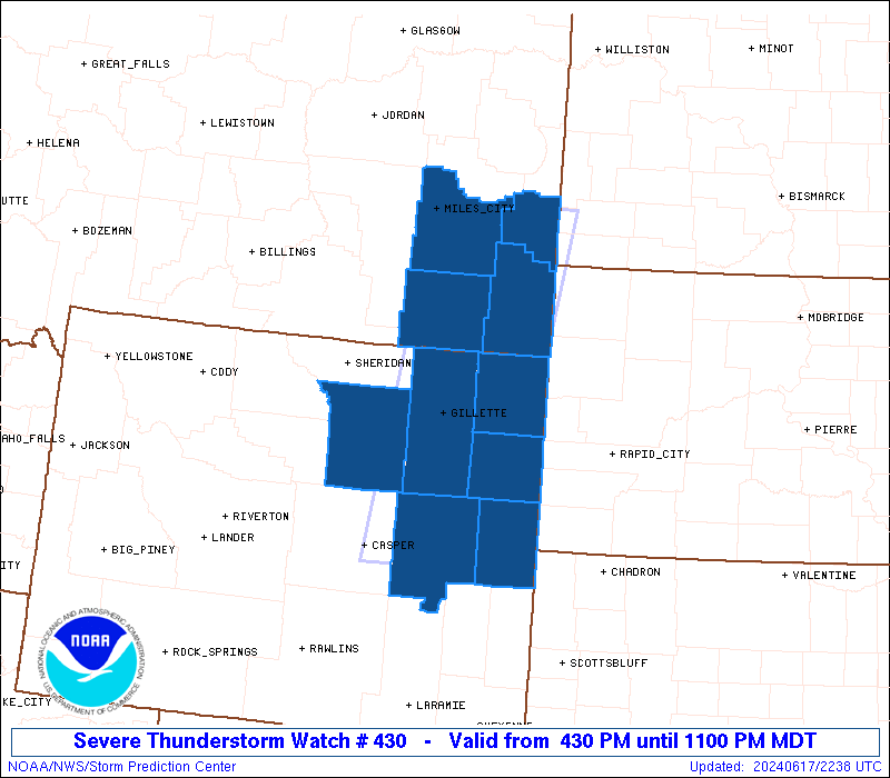
Initial List of Counties in SPC Severe Thunderstorm Watch 430 (WOU)
|
Back to Watch 430
|
 |
   WOUS64 KWNS 172230
   WOU0

   BULLETIN - IMMEDIATE BROADCAST REQUESTED
   SEVERE THUNDERSTORM WATCH OUTLINE UPDATE FOR WS 430
   NWS STORM PREDICTION CENTER NORMAN OK
   430 PM MDT MON JUN 17 2024

   SEVERE THUNDERSTORM WATCH 430 IS IN EFFECT UNTIL 1100 PM MDT
   FOR THE FOLLOWING LOCATIONS

   MTC011-017-025-075-180500-
   /O.NEW.KWNS.SV.A.0430.240617T2230Z-240618T0500Z/

   MT
   .    MONTANA COUNTIES INCLUDED ARE

   CARTER               CUSTER              FALLON
   POWDER RIVER


   WYC005-009-011-019-027-045-180500-
   /O.NEW.KWNS.SV.A.0430.240617T2230Z-240618T0500Z/

   WY
   .    WYOMING COUNTIES INCLUDED ARE

   CAMPBELL             CONVERSE            CROOK
   JOHNSON              NIOBRARA            WESTON


   ATTN...WFO...BYZ...UNR...CYS...RIW...
|
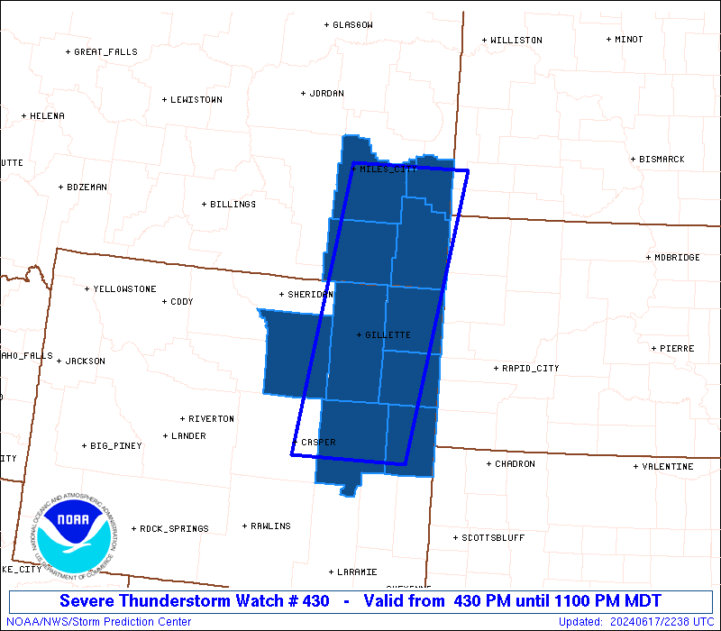
| Aviation Watch (SAW) for WW430 |
|---|
 |
| Note:
The Aviation Watch (SAW) product is an approximation to the watch area.
The actual watch is depicted by the shaded areas. |
   SAW0
   WW 430 SEVERE TSTM MT WY 172230Z - 180500Z
   AXIS..50 STATUTE MILES EAST AND WEST OF LINE..
   110S GCC/GILLETTE WY/ - 30WNW BHK/BAKER MT/
   ..AVIATION COORDS.. 45NM E/W /39ESE DDY - 47E MLS/
   HAIL SURFACE AND ALOFT..2 INCHES. WIND GUSTS..60 KNOTS.
   MAX TOPS TO 500. MEAN STORM MOTION VECTOR 21030.

   LAT...LON 42750652 46520588 46520378 42750454

   THIS IS AN APPROXIMATION TO THE WATCH AREA.  FOR A
   COMPLETE DEPICTION OF THE WATCH SEE WOUS64 KWNS
   FOR WOU0.
|
|


 @NWSSPC