|
| Mesoscale Discussion 685 |
|
< Previous MD Next MD >
|

|
   Mesoscale Discussion 0685
   NWS Storm Prediction Center Norman OK
   0656 PM CDT Tue May 07 2024

   Areas affected...Ohio Valley

   Concerning...Tornado Watch 195...197...

   Valid 072356Z - 080130Z

   The severe weather threat for Tornado Watch 195, 197 continues.

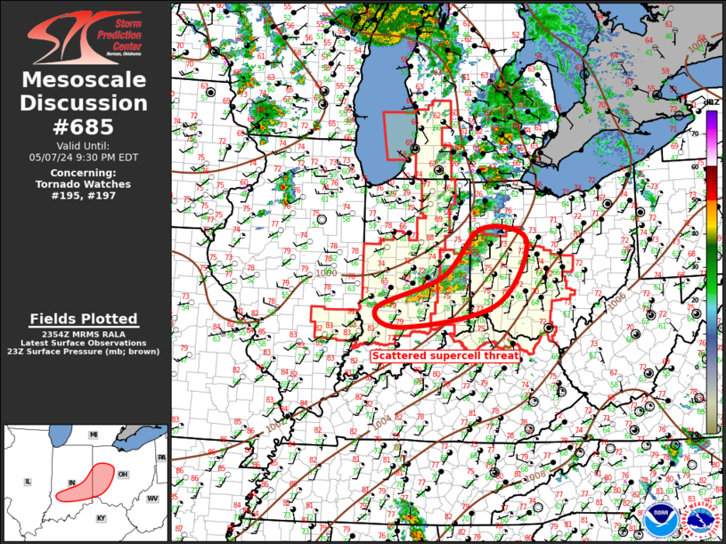
   SUMMARY...Scattered supercells will spread across southern/eastern
   IN into western OH over the next several hours. Tornado threat
   continues, along with a risk for large hail.

   DISCUSSION...Scattered supercells have grown upscale, gradually
   maturing as they spread across eastern/southern IN toward western
   OH. Air mass remains modestly unstable, and strongly sheared. 21z
   ILN sounding exhibited SBCAPE around 2500 J/kg, with 300 m2/s2 0-3
   SRH. This activity is expected to spread east-northeast this evening
   within an environment that is favorable for sustaining long-lived
   rotating updrafts, including the possibility for tornadoes.

   ..Darrow.. 05/07/2024

   ...Please see www.spc.noaa.gov for graphic product...

   ATTN...WFO...CLE...ILN...IWX...IND...

   LAT...LON   39238717 39858549 40788452 40558336 39298415 38848655
               39238717
|
|
Top/All Mesoscale Discussions/Forecast Products/Home
|
|


