|
| Mesoscale Discussion 740 |
|
< Previous MD Next MD >
|
|
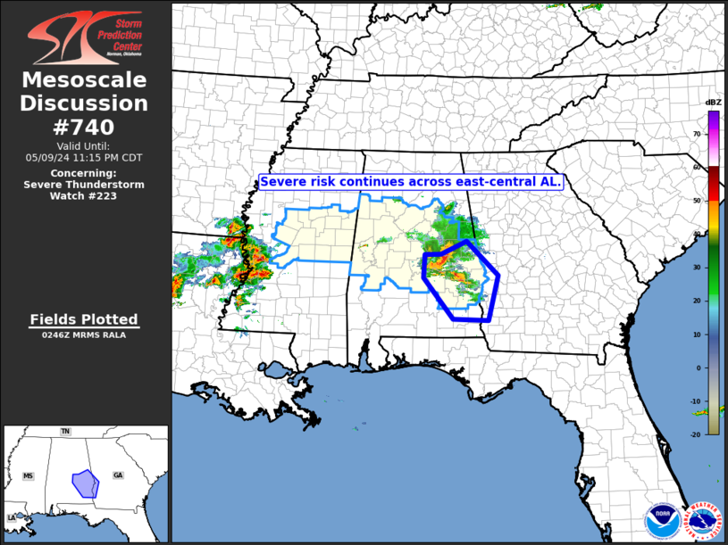
   Mesoscale Discussion 0740
   NWS Storm Prediction Center Norman OK
   0949 PM CDT Thu May 09 2024

   Areas affected...east-central Mississippi and eastward across
   central Alabama

   Concerning...Severe Thunderstorm Watch 223...

   Valid 100249Z - 100415Z

   The severe weather threat for Severe Thunderstorm Watch 223
   continues.

   SUMMARY...Strong/locally severe storms continue across central
   Alabama.

   DISCUSSION...Storms across central Alabama have recently evolved
   into a bowing cluster, which is moving southeastward toward the
   Montgomery area and likely accompanied by damaging winds.

   On this trajectory, the storms will eventually begin to encounter a
   more stable airmass across far southeastern Alabama and into
   southwestern Georgia.  This should eventually prove to be a negative
   in terms of storm intensity/wind risk, and may preclude the urgency
   for a downstream WW.  In the mean time, damaging wind risk has
   increased across east-central Alabama.

   ..Goss.. 05/10/2024

   ...Please see www.spc.noaa.gov for graphic product...

   ATTN...WFO...FFC...TAE...BMX...MOB...

   LAT...LON   32288654 32778651 32788609 33078544 32328464 31358490
               31388578 32288654
|
|
Top/All Mesoscale Discussions/Forecast Products/Home
|
|


 @NWSSPC