|
| Mesoscale Discussion 783 |
|
< Previous MD Next MD >
|
|
Mesoscale Discussion 0783
NWS Storm Prediction Center Norman OK
0348 PM CDT Tue May 14 2024
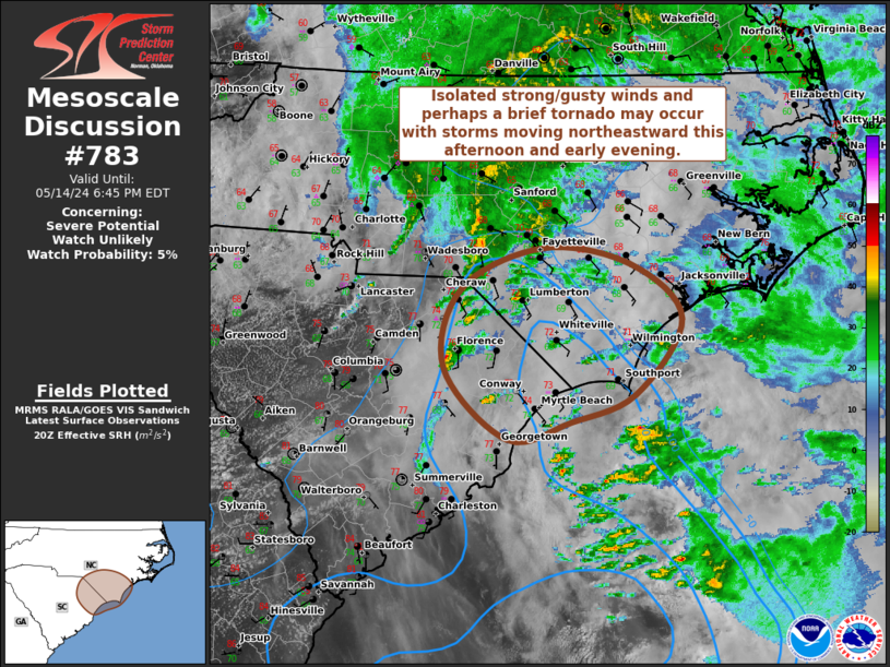
Areas affected...Portions of coastal/eastern SC into
coastal/southern NC
Concerning...Severe potential...Watch unlikely
Valid 142048Z - 142245Z
Probability of Watch Issuance...5 percent
SUMMARY...Isolated strong/gusty winds and perhaps a brief tornado
may occur with thunderstorms moving northeastward this afternoon and
early evening. Watch issuance is not expected at this time.
DISCUSSION...An MCV related to convection that occurred earlier
today across the Southeast remains evident over central NC and
vicinity this afternoon. Although cloud cover has remained prevalent
across coastal NC/SC today, modest daytime heating of a moist
low-level airmass has occurred. Corresponding weak instability
(MLCAPE generally 250-750 J/kg) may be sufficient to support
surface-based convection through the rest of the afternoon and into
the early evening along/near the NC/SC Coast. Latest VWP from KLTX
shows a veering/strengthening wind profile with height through mid
levels, associated with the MCV. Even though there appears to be
some weakness in the flow in the 1-2 km AGL layer, around 100-200
m2/s2 of effective SRH may still support low-level updraft rotation
and the threat for a brief tornado with any cell that can
strengthen. Isolated strong/gusty winds may also occur. The overall
severe threat is expected to remain marginal/isolated due to the
limited instability, and watch issuance is not expected at this
time.
..Gleason/Thompson.. 05/14/2024
...Please see www.spc.noaa.gov for graphic product...
ATTN...WFO...MHX...RAH...ILM...
LAT...LON 33417920 34017987 34707968 35057883 34927793 34457739
33807788 33557854 33417920
|
|
Top/All Mesoscale Discussions/Forecast Products/Home
|
|


 @NWSSPC