|
| Mesoscale Discussion 849 |
|
< Previous MD Next MD >
|
|
Mesoscale Discussion 0849
NWS Storm Prediction Center Norman OK
0343 AM CDT Mon May 20 2024
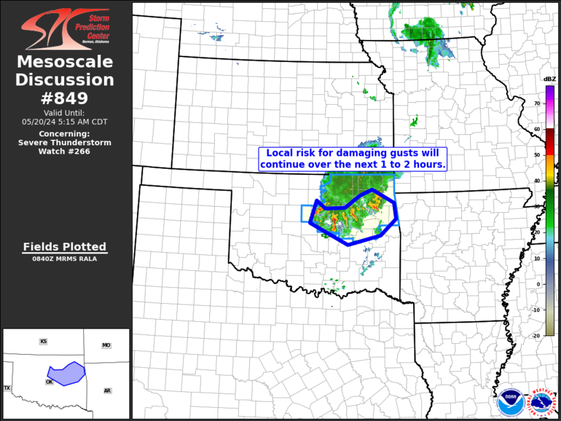
Areas affected...northeastern and east-central Oklahoma
Concerning...Severe Thunderstorm Watch 266...
Valid 200843Z - 201015Z
The severe weather threat for Severe Thunderstorm Watch 266
continues.
SUMMARY...Locally strong/damaging gusts will likely continue over
the next 1 to 2 hours, though a gradual decrease in convective
intensity is anticipated.
DISCUSSION...Latest radar loop shows a cluster of convection across
roughly the northeastern quarter of Oklahoma -- most intense along
its southern flank. As the individual storms move in a generally
easterly direction at around 35 kt, the overall area of storms
continues to sag gradually southeastward -- north of
southward-moving outflow.
With the convection slightly elevated for the most part atop the
aforementioned outflow, severe-caliber wind gusts have become
sparse, with the last reported about around 3 AM at Tulsa (51 kt).
In general, a slow decreasing trend in convective intensity (and
thus severe potential) should continue over the next couple of
hours, as storms encounter a progressive/gradual decrease in
surface-based instability both areally and temporally. Still, an
occasional stronger gust or two -- near severe levels -- will remain
possible in the short term.
..Goss.. 05/20/2024
...Please see www.spc.noaa.gov for graphic product...
ATTN...WFO...TSA...OUN...
LAT...LON 35699739 36309717 36089689 36109625 36429577 36609534
36239462 35809456 35379508 35129615 35699739
|
|
Top/All Mesoscale Discussions/Forecast Products/Home
|
|


 @NWSSPC