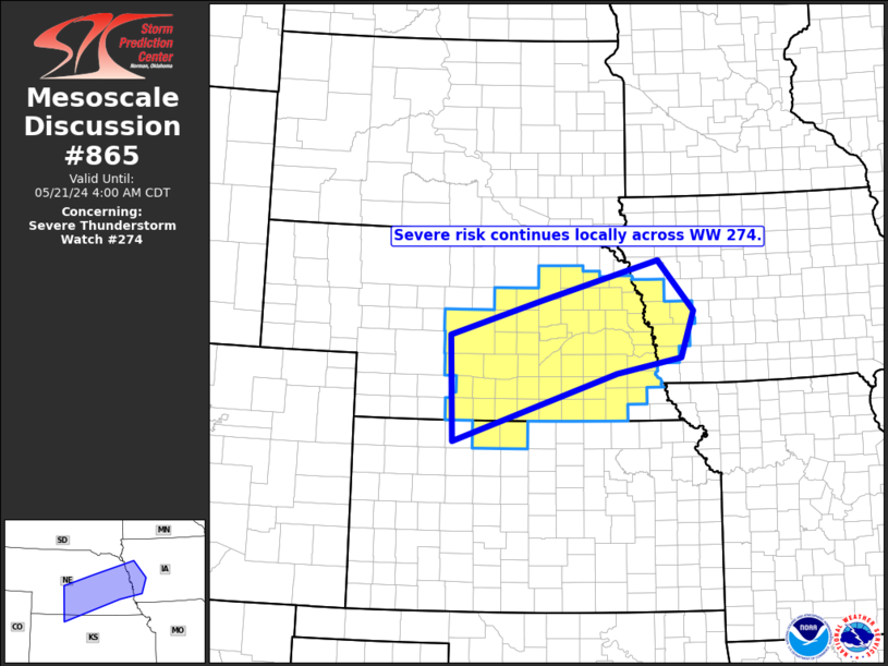
   Mesoscale Discussion 0865
   NWS Storm Prediction Center Norman OK
   0204 AM CDT Tue May 21 2024

   Areas affected...southern and eastern Nebraska...north-central
   Kansas...and into parts of western Iowa

   Concerning...Severe Thunderstorm Watch 274...

   Valid 210704Z - 210900Z

   The severe weather threat for Severe Thunderstorm Watch 274
   continues.

   SUMMARY...Strong/locally severe storms continue in/near WW 274.

   DISCUSSION...Latest radar loop shows widespread convection across
   eastern Nebraska and eastward into western and central Iowa.  While
   a relatively favorable thermodynamic environment is in place, rather
   paltry shear is indicated, with only 20 to 30 kt flow through most
   of the troposphere, per model output and confirmed via KDMX WSR-88d
   VWP.  With this area to remain east of the low-level jet, and
   associated enhancement to the wind profile thereby provided, expect
   only isolated risk for marginal hail/wind with the strongest
   multicell storms.

   Greater severe potential is expected to evolve across southwestern
   portions of the watch over the next 1 to 2 hours, as a bowing
   cluster of storms with a fairly well-developed cold pool moves
   eastward across southwestern Nebraska/northwestern Kansas.  The
   convection is progressing eastward near and just north of the
   surface front, within the surface-based CAPE gradient.  With the MCS
   roughly co-located with the nose of a 60-kt southerly low-level jet,
   a much more favorably sheared environment should sustain this
   convection -- and attendant, more substantial severe potential, over
   the next few hours.

   ..Goss.. 05/21/2024

   ...Please see www.spc.noaa.gov for graphic product...

   ATTN...WFO...DMX...FSD...OAX...GID...LBF...GLD...

   LAT...LON   41340010 41889822 42519580 41719507 40989534 40739667
               39660003 41340010
|


 @NWSSPC