|
| Mesoscale Discussion 907 |
|
< Previous MD Next MD >
|

|
   Mesoscale Discussion 0907
   NWS Storm Prediction Center Norman OK
   0804 AM CDT Thu May 23 2024

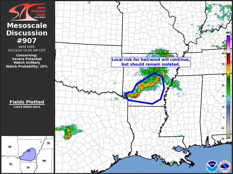
   Areas affected...central and southern Arkansas

   Concerning...Severe potential...Watch unlikely

   Valid 231304Z - 231500Z

   Probability of Watch Issuance...20 percent

   SUMMARY...A strong gust or two -- or marginal hailstone -- will
   remain possible across central/southern Arkansas over the next
   couple of hours.  Marginal/isolated nature of the risk should
   preclude WW issuance.

   DISCUSSION...Latest radar loop shows storms over southwestern
   Arkansas evolving a bit upscale linearly, with some bowing evident
   -- suggesting an at least somewhat-organized cold pool.  Flow
   through the lower troposphere remains moderate/southwesterly, and
   thus not overly supporting well-organized storms.  Additionally the
   morning LZK RAOB reveals an anticipated/nocturnally induced weakly
   stable surface-based layer.  These factors should act to limit
   overall wind risk, but with a stronger gust or two possible.
   Marginal hail near severe levels may occur with a stronger updraft
   or two.  Overall however, given limited local risk apparent at this
   time, WW issuance is not expected at this time.

   ..Goss/Edwards.. 05/23/2024

   ...Please see www.spc.noaa.gov for graphic product...

   ATTN...WFO...JAN...LZK...SHV...

   LAT...LON   33809426 34009366 34439339 34809272 35199193 34979133
               34209118 33479147 33179213 33409400 33809426
|
|
Top/All Mesoscale Discussions/Forecast Products/Home
|
|


