|
| Mesoscale Discussion 977 |
|
< Previous MD Next MD >
|

|
   Mesoscale Discussion 0977
   NWS Storm Prediction Center Norman OK
   0136 PM CDT Sun May 26 2024

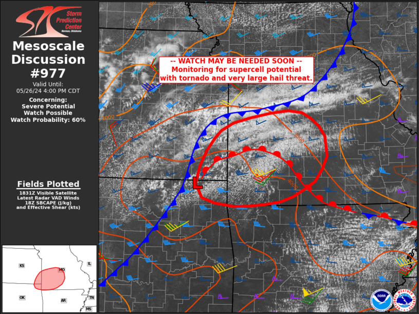
   Areas affected...far southeast Kansas into southwest Missouri

   Concerning...Severe potential...Watch possible

   Valid 261836Z - 262100Z

   Probability of Watch Issuance...60 percent

   SUMMARY...Storm producing very large hail and a few tornadoes may
   develop in the next 2 hours into southwest Missouri and vicinity.

   DISCUSSION...Surface analysis shows a low close to the KS/OK/MO
   tri-state area, where cumulus fields continue to deepen. This region
   is just ahead of a developing cold front with a deep layer of
   moisture convergence, and just north of a steep low-level lapse rate
   plume over eastern OK.

   Given the steep lapse rates aloft and continued heating near the
   surface low and front, storms may form within 1-2 hours here. Both
   instability and wind profiles favor supercells producing very large
   hail, and, a tornado risk will likely increase as storms proceed
   east into a more favorable low-level shear environment.

   ..Jewell/Bunting.. 05/26/2024

   ...Please see www.spc.noaa.gov for graphic product...

   ATTN...WFO...SGF...EAX...TSA...ICT...

   LAT...LON   36569329 36489445 36659525 36939540 37299531 37609514
               37859493 38159446 38409307 38249250 37889215 37489210
               36969241 36799274 36569329
|
|
Top/All Mesoscale Discussions/Forecast Products/Home
|
|


