Mesoscale Discussion 1058
NWS Storm Prediction Center Norman OK
0703 PM CDT Tue May 28 2024
Areas affected...Portions of West Texas
Concerning...Tornado Watch 344...345...
Valid 290003Z - 290130Z
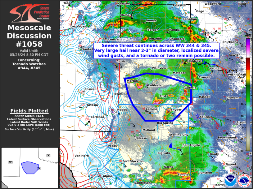
The severe weather threat for Tornado Watch 344, 345 continues.
SUMMARY...The threat of large hail near 2-3" in diameter, severe
wind gusts, and perhaps a tornado or two will continue across
portions of West Texas through sunset.
DISCUSSION...A few discrete supercells from west of Lubbock to just
southeast of Tahoka will continue to progress east and southeastward
through the early evening hours. Several large hail reports have
been noted with these thunderstorms, with nearly a 5" hail stone
observed northwest of Levelland. The environment remains favorable
for supercells, and specifically large hail, given steep mid-level
lapse rates of 8-8.5 C/km, and westerly deep effective shear of
60-70 kt via the MAF & LBB VAD profilers. However, as the evening
progresses, maximum hail sizes should decrease with waning buoyancy.
..Barnes.. 05/29/2024
...Please see www.spc.noaa.gov for graphic product...
ATTN...WFO...SJT...LUB...MAF...
LAT...LON 32940245 33330266 33860281 33930248 34070192 34030136
33670001 33020004 32390079 32400194 32940245
|


 @NWSSPC