|
| Mesoscale Discussion 1070 |
|
< Previous MD Next MD >
|

|
   Mesoscale Discussion 1070
   NWS Storm Prediction Center Norman OK
   0536 PM CDT Wed May 29 2024

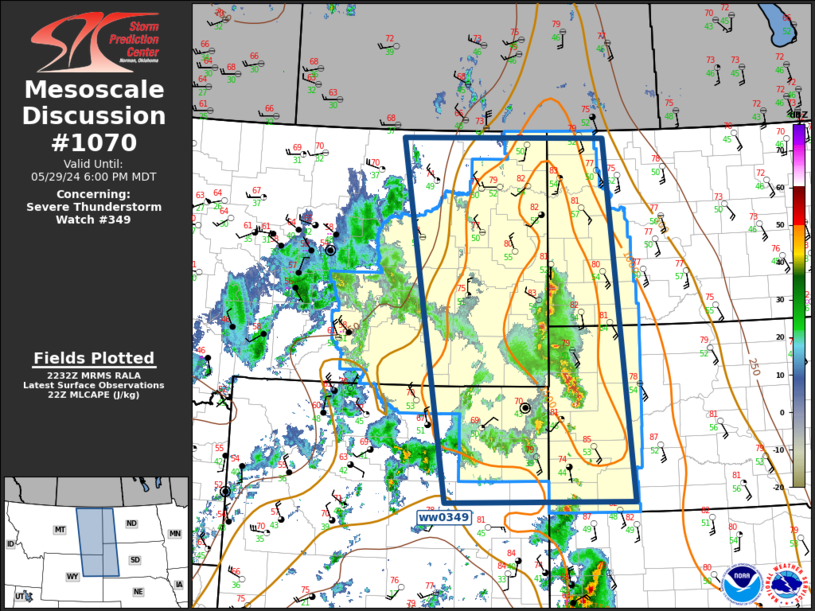
   Areas affected...Northern High Plains

   Concerning...Severe Thunderstorm Watch 349...

   Valid 292236Z - 300000Z

   The severe weather threat for Severe Thunderstorm Watch 349
   continues.

   SUMMARY...Scattered strong/severe thunderstorms will shift east this
   evening.

   DISCUSSION...Weak mid-level height falls are beginning to suppress
   the northern Plains ridge early this evening. Scattered convection
   that evolved over northeast WY has progressed downstream into the
   primary instability axis characterized by MLCAPE on the order of
   1500 J/kg. This activity should continue advancing east this evening
   as LLJ is expected to increase markedly after sunset in response to
   the approaching upper trough. Latest radar data suggests many
   updrafts are generating hail, the most robust updrafts may be
   producing hail in excess of 1.5 inches. Gusty winds may also
   accompany this activity as it advances downstream.

   ..Darrow.. 05/29/2024

   ...Please see www.spc.noaa.gov for graphic product...

   ATTN...WFO...BIS...UNR...CYS...BYZ...GGW...RIW...

   LAT...LON   43150632 48870738 48870274 43150215 43150632
|
|
Top/All Mesoscale Discussions/Forecast Products/Home
|
|


