|
| Mesoscale Discussion 1097 |
|
< Previous MD Next MD >
|

|
   Mesoscale Discussion 1097
   NWS Storm Prediction Center Norman OK
   0525 PM CDT Fri May 31 2024

   Areas affected...Northeast New Mexico...Western Oklahoma
   Panhandle...Western and Central Texas Panhandle...West Texas

   Concerning...Severe Thunderstorm Watch 360...

   Valid 312225Z - 010030Z

   The severe weather threat for Severe Thunderstorm Watch 360
   continues.

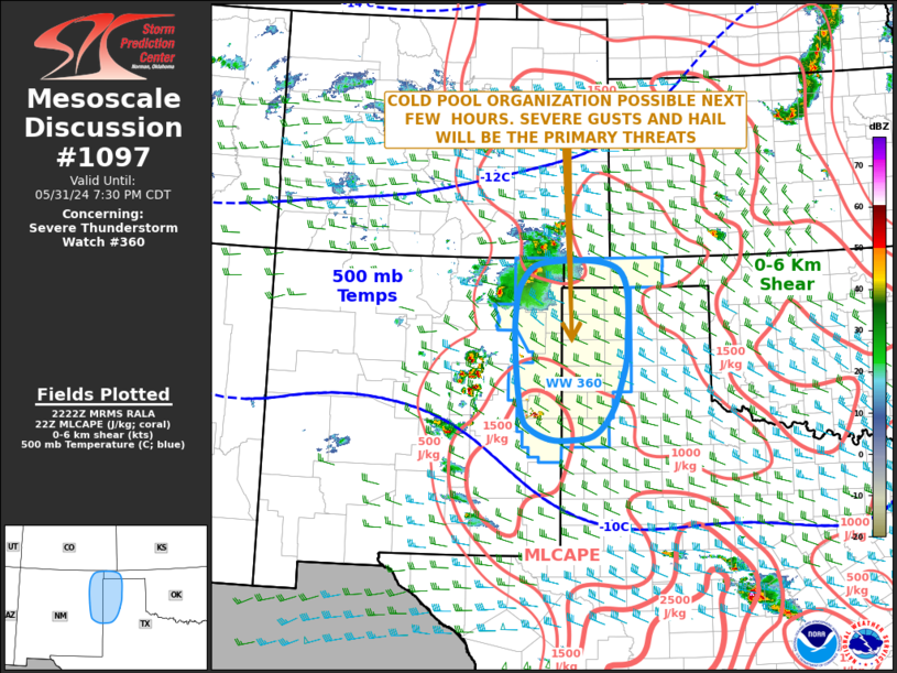
   SUMMARY...The severe threat is expected to increase across the
   southern High Plains over the next few hours. Large hail and severe
   wind gusts will be the primary threats.

   DISCUSSION...Latest surface analysis has a meso-low over southern
   Colorado with a surface trough extending southward across
   east-central New Mexico. Scattered thunderstorms are developing in
   the higher terrain of northeast and east-central New Mexico. These
   storms will continue to move into the lower elevations over the next
   few hours. Surface dewpoints ahead of the storms generally range
   from the upper 40s to mid 50s F. This is contributing to about 1000
   J/kg of MLCAPE, according to the RAP. In addition, the latest
   WSR-88D VWP at Tucumcari has 0-6 km shear near 35 knots with
   considerable directional shear in the lowest 3 km. This should
   support a severe threat with large hail and severe wind gusts
   possible, as cells move southeastward into the Texas Panhandle and
   west Texas later this evening. If a cold pool can become organized,
   then the potential for severe wind gusts would increase.

   ..Broyles/Hart.. 05/31/2024

   ...Please see www.spc.noaa.gov for graphic product...

   ATTN...WFO...LUB...AMA...ABQ...

   LAT...LON   36930333 36610384 35960399 35090396 34350385 34120369
               33950327 33930282 34010239 34310207 34790185 35530169
               36780184 36930333
|
|
Top/All Mesoscale Discussions/Forecast Products/Home
|
|


