|
| Mesoscale Discussion 1104 |
|
< Previous MD Next MD >
|

|
   Mesoscale Discussion 1104
   NWS Storm Prediction Center Norman OK
   0608 AM CDT Sat Jun 01 2024

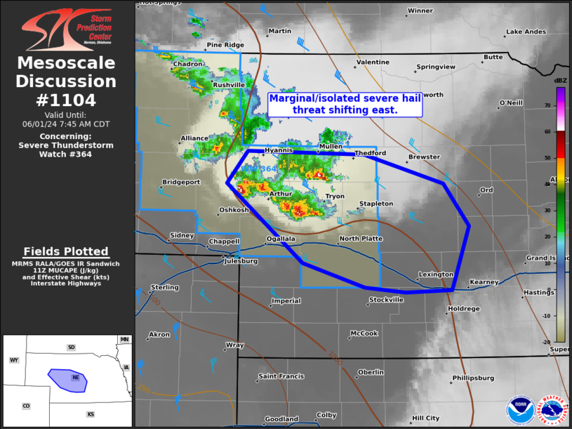
   Areas affected...Western to central NE

   Concerning...Severe Thunderstorm Watch 364...

   Valid 011108Z - 011245Z

   The severe weather threat for Severe Thunderstorm Watch 364
   continues.

   SUMMARY...A marginal and isolated severe hail threat should persist
   across the southeast portion of WW 364 as it shift towards the US-83
   corridor, north of I-80. An additional severe thunderstorm watch
   farther east is unlikely.

   DISCUSSION...While the number of supercells has subsided, one
   probable severe hailer is ongoing over eastern Garden County along
   with a couple strong cells farther east. Overall environment should
   support potential for an isolated, lower-end severe hail threat
   (i.e., 1-1.5 inches in diameter) into mid-morning. With low-level
   flow becoming more veered in upstream VWPs (GLD and FTG), subsiding
   moist advection is anticipated. This in combination with eastward
   expansion of the central High Plains elevated mixed layer should
   yield eventually diminishing elevated supercell potential later in
   the morning.

   ..Grams.. 06/01/2024

   ...Please see www.spc.noaa.gov for graphic product...

   ATTN...WFO...GID...LBF...

   LAT...LON   42040195 42000042 41719938 41309906 40729926 40669929
               40659988 40690042 40930122 41720223 42040195
|
|
Top/All Mesoscale Discussions/Forecast Products/Home
|
|


