|
| Mesoscale Discussion 1132 |
|
< Previous MD Next MD >
|

|
   Mesoscale Discussion 1132
   NWS Storm Prediction Center Norman OK
   0325 PM CDT Sun Jun 02 2024

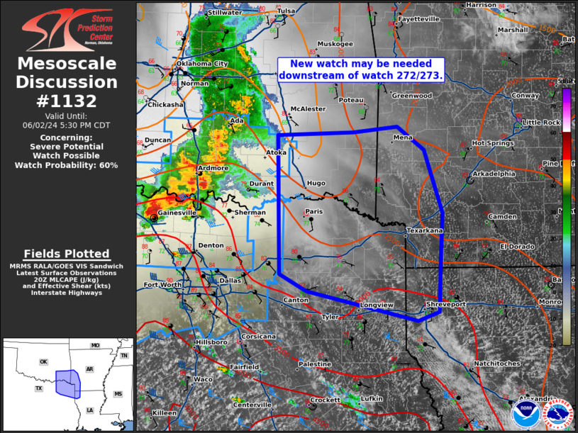
   Areas affected...southeast Oklahoma...northeast Texas...southwest
   Arkansas...and northwest Louisiana

   Concerning...Severe potential...Watch possible 372...373...

   Valid 022025Z - 022230Z

   Probability of Watch Issuance...60 percent

   SUMMARY...A new severe thunderstorm watch may be needed downstream
   of watch 272/273.

   DISCUSSION...The airmass ahead of a well-established line of storms
   continues to destabilize with mid-70s dewpoints and temperatures in
   the mid 80s across northeast Texas. Given this strongly unstable
   downstream environment (2000-3500 J/kg MLCAPE), expect this storm
   cluster to continue southeast with a threat for isolated large hail
   and severe wind gusts this evening.

   ..Bentley/Smith.. 06/02/2024

   ...Please see www.spc.noaa.gov for graphic product...

   ATTN...WFO...LZK...SHV...TSA...FWD...OUN...

   LAT...LON   34669595 34709482 34789416 34489376 33709349 33159352
               32469354 32359385 32739550 32949590 34669595
|
|
Top/All Mesoscale Discussions/Forecast Products/Home
|
|


