|
| Mesoscale Discussion 1234 |
|
< Previous MD Next MD >
|
|
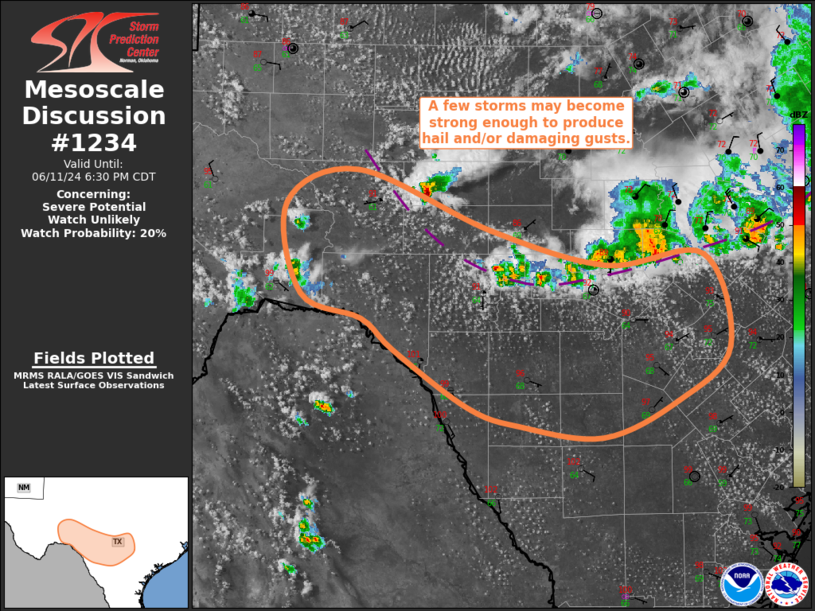
   Mesoscale Discussion 1234
   NWS Storm Prediction Center Norman OK
   0353 PM CDT Tue Jun 11 2024

   Areas affected...Texas Hill Country...Permian Basin

   Concerning...Severe potential...Watch unlikely

   Valid 112053Z - 112330Z

   Probability of Watch Issuance...20 percent

   SUMMARY...A few of storms may become strong enough to briefly
   produce hail and/or damaging gusts from the Permian Basin into the
   Texas Hill Country this afternoon.

   DISCUSSION...Recent satellite imagery shows a well-defined outflow
   boundary just ahead of the showers and thunderstorms over central
   TX. Convergence along the western portion of the boundary likely
   contributed to the initiation of the robust thunderstorm over
   Schleicher County TX. The airmass downstream of this outflow is
   moist, with dewpoints in the upper 60s/low 70s, but warm
   temperatures aloft are mitigating the overall buoyancy. Recent
   mesoanalysis estimates MLCAPE from 1000 to 1500 J/kg. Vertical shear
   is modest as well, with mesoanalysis estimating effective bulk shear
   is currently around 30 kt. Even so, persistent low-level convergence
   along the outflow boundary, particularly the western portion of the
   boundary, will likely lead to the development of additional
   thunderstorms. A few of these storms may become strong enough to
   briefly produce hail and/or damaging gusts. Isolated coverage and
   limited intensity and duration is anticipated, precluding the need
   for a watch.

   ..Mosier/Smith.. 06/11/2024

   ...Please see www.spc.noaa.gov for graphic product...

   ATTN...WFO...EWX...SJT...MAF...

   LAT...LON   29460104 29730137 29930197 30720212 31000140 30490009
               30189895 30279799 29489774 29019825 28719899 28809980
               28970032 29460104
|
|
Top/All Mesoscale Discussions/Forecast Products/Home
|
|


 @NWSSPC