|
| Mesoscale Discussion 1674 |
|
< Previous MD Next MD >
|

|
   Mesoscale Discussion 1674
   NWS Storm Prediction Center Norman OK
   0611 PM CDT Wed Jul 17 2024

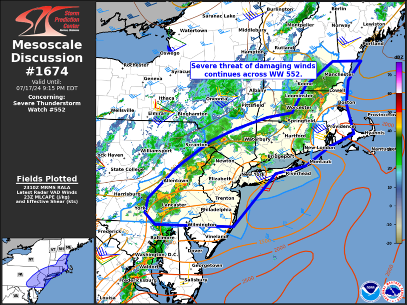
   Areas affected...Portions of southern New England and the
   Mid-Atlantic

   Concerning...Severe Thunderstorm Watch 552...

   Valid 172311Z - 180115Z

   The severe weather threat for Severe Thunderstorm Watch 552
   continues.

   SUMMARY...A severe threat of damaging winds, and perhaps marginally
   severe hail, will continue across portions of southern New England
   and the Mid-Atlantic over the next 2-3 hours. Local watch extensions
   in time appear likely.

   DISCUSSION...Latest radar trends indicate two areas of damaging wind
   concerns across northern MA, and southward into far eastern PA. A
   small bowing segment, and a cluster of relatively robust updrafts
   are present within these regions. Although MLCIN should slowly begin
   to increase with the approach of sunset, surface observations across
   NJ ahead of the cluster suggest an undisturbed, buoyant air mass
   remains in place. Temperatures in the upper 80s to low 90s, along
   with dewpoints in the low 70s, is contributing to MLCAPE ~1000-1500
   J/kg. Cell mergers occurring through this evening will have the
   opportunity to produce severe wind gusts with deepening cold pools.
   This may especially be true across portions of southern NJ where
   slightly stronger low-level flow exists. A bowing segment or two
   will also remain possible here. A local extension in time will
   likely be needed for portions of the watch.

   ..Barnes.. 07/17/2024

   ...Please see www.spc.noaa.gov for graphic product...

   ATTN...WFO...GYX...BOX...OKX...ALY...PHI...BGM...CTP...LWX...

   LAT...LON   43357027 43367115 42827199 42227242 42117317 41857410
               41597484 40987583 40257668 39927677 39677645 39657416
               40857293 41017202 41457128 41727056 42407076 42927068
               43357027
|
|
Top/All Mesoscale Discussions/Forecast Products/Home
|
|


