|
| Mesoscale Discussion 1679 |
|
< Previous MD Next MD >
|
|
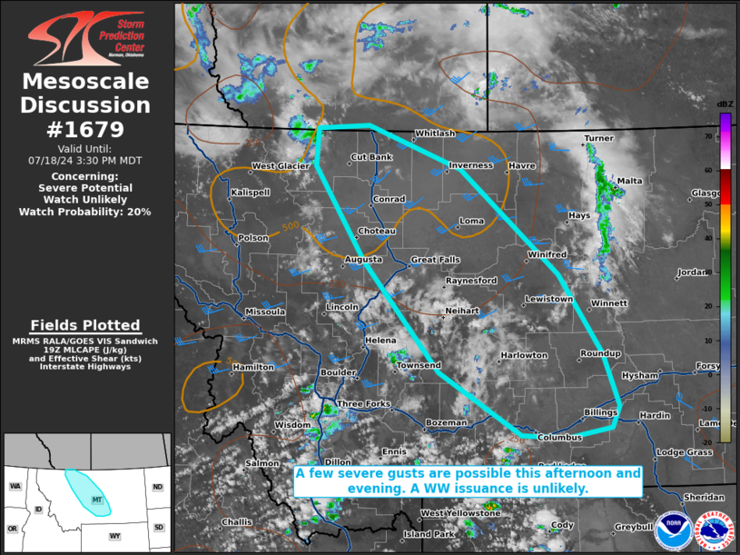
   Mesoscale Discussion 1679
   NWS Storm Prediction Center Norman OK
   0232 PM CDT Thu Jul 18 2024

   Areas affected...portions of central Montana

   Concerning...Severe potential...Watch unlikely

   Valid 181932Z - 182130Z

   Probability of Watch Issuance...20 percent

   SUMMARY...A few severe gusts are possible across portions of central
   MT this afternoon and evening. The severe threat is currently
   expected to remain sparse, so a WW issuance is not anticipated.

   DISCUSSION...A mid-level impulse/500 mb vort max is pivoting around
   the upper ridge while traversing the AB/MT border area, which in
   tandem with strong surface heating, is supporting recent attempts at
   convective initiation (per latest visible satellite). While MLCINH
   still remains (per 19Z mesoanalysis), continued surface heating and
   approach of the 500 mb vort max should support a gradual increase in
   coverage and intensity of thunderstorms this afternoon. Some
   vertical speed shear induced by the approaching mid-level impulse
   will support elongated hodographs, with multicell clusters and
   perhaps a transient supercell or two possible. 19Z mesoanalysis also
   shows 8+ C/km lapse rates extending from just above the surface to
   over 500 mb, indicative of the potential for efficient downward
   momentum transport via evaporative cooling. As such, any storm that
   develops has at least some potential for producing a severe gust.

   At the moment, it appears that the severe threat should be isolated,
   so a WW issuance is not currently expected.

   ..Squitieri.. 07/18/2024

   ...Please see www.spc.noaa.gov for graphic product...

   ATTN...WFO...BYZ...GGW...TFX...

   LAT...LON   45600946 46311081 47541204 48591287 49021283 49051199
               48571046 47400885 46500814 45910789 45680800 45570872
               45600946
|
|
Top/All Mesoscale Discussions/Forecast Products/Home
|
|


 @NWSSPC