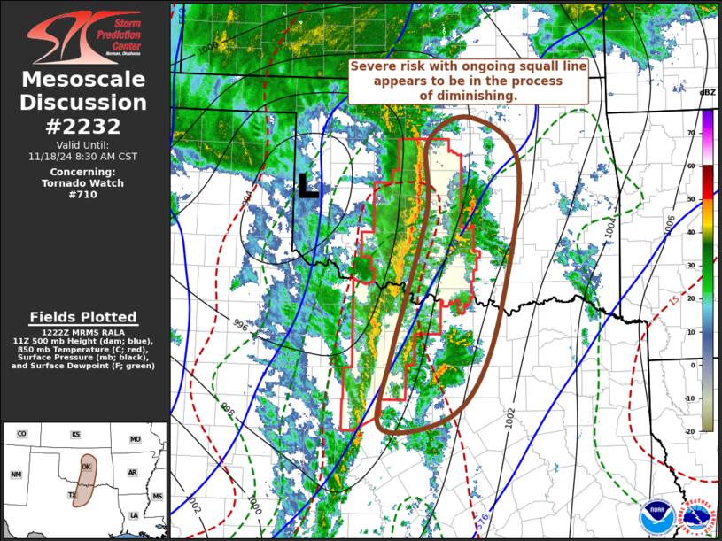
   Mesoscale Discussion 2232
   NWS Storm Prediction Center Norman OK
   0625 AM CST Mon Nov 18 2024

   Areas affected...parts of north central Texas through
   central/eastern Oklahoma

   Concerning...Tornado Watch 710...

   Valid 181225Z - 181430Z

   The severe weather threat for Tornado Watch 710 continues.

   SUMMARY...The risk for damaging wind gusts and isolated tornadoes
   appears in the process of diminishing, as storms progress into and
   east of the I-35 corridor.  A new severe weather watch is not
   currently anticipated in the near term.

   DISCUSSION...The narrow, strongly forced squall line has undergone
   at least some recent general weakening.  Based on latest Rapid
   Refresh output, it appears to have overtaken the narrow pre-frontal
   plume of higher northward returning low-level moisture content, and
   advanced well ahead of the leading edge of stronger mid-level
   cooling.  In the presence of weaker lower/mid-tropospheric lapse
   rates, and a residual stable near-surface layer, the potential for
   damaging wind gusts and perhaps brief tornadoes seems likely to
   diminish as activity spreads across and east of the I-35 corridor,
   particularly to the north of the Red River.

   More uncertainty exists to the south of the Red River, within
   continuing better low-level moisture return from the northwestern
   Gulf.  However, potential for appreciable thunderstorm
   intensification may await destabilization aided by daytime heating,
   and forcing associated with the next perturbation progressing
   through the base of the larger-scale mid-level troughing pivoting
   east-northeast of the South Plains.

   ..Kerr.. 11/18/2024

   ...Please see www.spc.noaa.gov for graphic product...

   ATTN...WFO...TSA...FWD...OUN...

   LAT...LON   36119770 36469699 35829616 33879644 32699689 32189753
               32139849 33169829 35109772 36119770
|


 @NWSSPC