|
| Mesoscale Discussion 2262 |
|
< Previous MD Next MD >
|
|
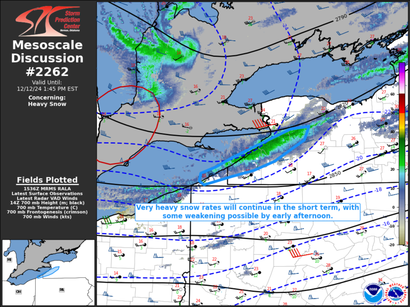
   Mesoscale Discussion 2262
   NWS Storm Prediction Center Norman OK
   0939 AM CST Thu Dec 12 2024

   Areas affected...Parts of western NY/extreme northwest PA downstream
   of Lake Erie

   Concerning...Heavy snow

   Valid 121539Z - 121845Z

   SUMMARY...Very heavy snow rates will continue in the short term,
   with some weakening possible by early afternoon.

   DISCUSSION...An intense lake-effect snow band is ongoing this
   morning across parts of western NY and extreme northwest PA,
   downstream of Lake Erie. Recent reports suggest snow rates in excess
   of 3 inches per hour in the heaviest part of the band, with one
   report of 12 inches over a 2 hour span in Erie County, NY. These
   very heavy snow rates will persist in some areas through the
   remainder of the morning. In addition, wind gusts of 30-45 kt have
   been noted across the region this morning, resulting in occasional
   blizzard conditions.

   A notable shortwave trough embedded in deep cyclonic flow is
   currently moving east of Lake Huron and approaching the lower Great
   Lakes region. Low-level flow response to this shortwave could result
   in some disruption of the ongoing snow band by early afternoon, and
   short-term guidance (including the 12Z CAMs) generally suggest the
   band will tend to drift south and at least temporarily weaken by
   early afternoon.

   ..Dean.. 12/12/2024

   ...Please see www.spc.noaa.gov for graphic product...

   ATTN...WFO...BUF...CLE...

   LAT...LON   42227920 42117968 41998025 42058034 42178032 42278001
               42427966 42867843 42907805 42687814 42367878 42227920
|
|
Top/All Mesoscale Discussions/Forecast Products/Home
|
|


 @NWSSPC