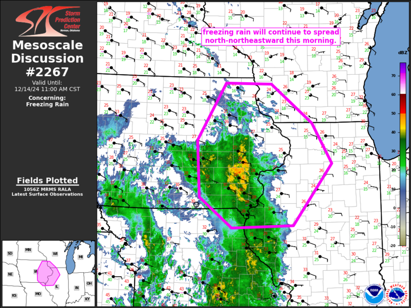
   Mesoscale Discussion 2267
   NWS Storm Prediction Center Norman OK
   0458 AM CST Sat Dec 14 2024

   Areas affected...eastern Iowa...northwestern Illinois...and vicinity

   Concerning...Freezing rain

   Valid 141058Z - 141700Z

   SUMMARY...Freezing rain -- at rates locally in excess of 0.10"/hour
   -- will continue spreading north-northeastward across eastern Iowa
   and into northwestern Illinois through midday.

   DISCUSSION...Latest radar loop shows an expansive area of
   precipitation ongoing from the Arklatex region northward across the
   Lower Missouri and Mid Mississippi Valleys this morning.  The
   precipitation is occurring in an area of warm
   advection/quasigeostropic ascent, east of a 1013 mb surface low over
   central Kansas, and associated upper low moving eastward across
   Nebraska and Kansas this morning.

   A cold boundary layer remains in place across this region, on the
   western fringe of a 1048 mb high centered in the vicinity of the
   Pennsylvania/New York border area.  As low-level theta-e advection
   continues ascending atop the cold low-level airmass, resulting
   ascent will continue to support the broad/ongoing area of
   precipitation over the next several hours.

   Currently, the surface freezing line extends from the Omaha area
   east-southeastward into southern Illinois north of the St. Louis
   area.  North of this line, mixed/wintry precipitation is observed,
   mainly in the form of freezing rain.  The most substantial freezing
   rain has occurred over southeastern Iowa recently, with KOTM
   (Ottumwa) reporting 0.13" in the past hour.  This area of moderate
   precipitation will continue spreading north-northeastward with time,
   across eastern Iowa and northwestern Illinois, with ice
   accumulations likely.

   ..Goss.. 12/14/2024

   ...Please see www.spc.noaa.gov for graphic product...

   ATTN...WFO...LOT...ILX...MKX...LSX...DVN...ARX...DMX...EAX...

   LAT...LON   40859281 42109289 43389206 43369069 42498949 41588893
               40229008 40169187 40859281
|


 @NWSSPC