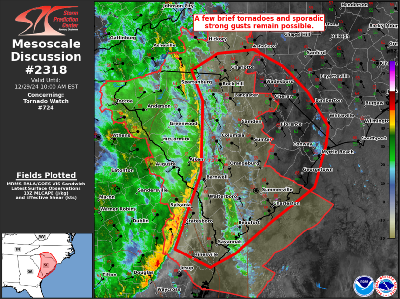
   Mesoscale Discussion 2318
   NWS Storm Prediction Center Norman OK
   0732 AM CST Sun Dec 29 2024

   Areas affected...the Lower Savannah Valley to southern NC

   Concerning...Tornado Watch 724...

   Valid 291332Z - 291500Z

   The severe weather threat for Tornado Watch 724 continues.

   SUMMARY...A few brief tornadoes and sporadic strong gusts should
   remain possible through midday with an extensive narrow QLCS. A
   downstream WW issuance is possible by late morning.

   DISCUSSION...Forward motion of a long-lived QLCS has remained
   steadily eastward at 40-45 kts. Despite rather strong low-level
   flow, measured surface gusts have consistently peaked at around 40
   kts across multiple sites in SC/GA (GMU, GSP, and AGS) during the
   past hour. The lack of stronger gusts is in part due to the scant
   instability and weak tropospheric lapse rates. Downstream 12Z
   soundings at CHS, MHX, and GSO sampled negligible buoyancy,
   suggesting that appreciable intensification is unlikely. Still, with
   0-1 km shear of 40-50 kts per the CAE VWP, transient mesovortices
   will remain possible, yielding brief tornado potential. These may
   tend to be more focused from the Lower Savannah Valley across SC
   where mid 60s surface dew points are sustained.

   ..Grams.. 12/29/2024

   ...Please see www.spc.noaa.gov for graphic product...

   ATTN...WFO...RAH...ILM...CHS...CAE...GSP...

   LAT...LON   34668143 35228167 35538110 35608031 35317969 34867917
               34217870 33887875 33117903 32487996 31938071 31678123
               31998198 33368144 34668143
|


 @NWSSPC