|
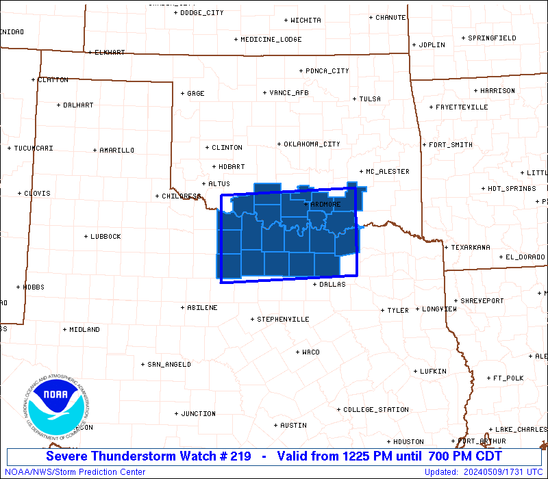
Initial List of Counties in SPC Severe Thunderstorm Watch 219 (WOU)
|
Back to Watch 219
|
 |
   WOUS64 KWNS 091722
   WOU9

   BULLETIN - IMMEDIATE BROADCAST REQUESTED
   SEVERE THUNDERSTORM WATCH OUTLINE UPDATE FOR WS 219
   NWS STORM PREDICTION CENTER NORMAN OK
   1225 PM CDT THU MAY 9 2024

   SEVERE THUNDERSTORM WATCH 219 IS IN EFFECT UNTIL 700 PM CDT
   FOR THE FOLLOWING LOCATIONS

   OKC005-013-019-033-067-069-085-095-099-137-100000-
   /O.NEW.KWNS.SV.A.0219.240509T1725Z-240510T0000Z/

   OK
   .    OKLAHOMA COUNTIES INCLUDED ARE

   ATOKA                BRYAN               CARTER
   COTTON               JEFFERSON           JOHNSTON
   LOVE                 MARSHALL            MURRAY
   STEPHENS


   TXC009-077-085-097-121-147-181-237-337-485-497-503-100000-
   /O.NEW.KWNS.SV.A.0219.240509T1725Z-240510T0000Z/

   TX
   .    TEXAS COUNTIES INCLUDED ARE

   ARCHER               CLAY                COLLIN
   COOKE                DENTON              FANNIN
   GRAYSON              JACK                MONTAGUE
   WICHITA              WISE                YOUNG


   ATTN...WFO...OUN...FWD...
|
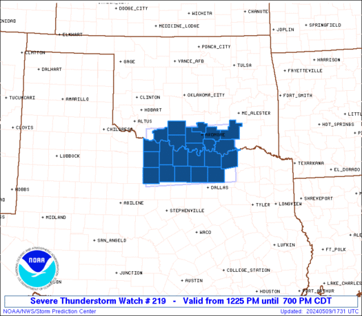
| Aviation Watch (SAW) for WW219 |
|---|
 |
| Note:
The Aviation Watch (SAW) product is an approximation to the watch area.
The actual watch is depicted by the shaded areas. |
   SAW9
   WW 219 SEVERE TSTM OK TX 091725Z - 100000Z
   AXIS..55 STATUTE MILES NORTH AND SOUTH OF LINE..
   30SW SPS/WICHITA FALLS TX/ - 30ESE DUA/DURANT OK/
   ..AVIATION COORDS.. 50NM N/S /24SW SPS - 64S MLC/
   HAIL SURFACE AND ALOFT..3.5 INCHES. WIND GUSTS..60 KNOTS.
   MAX TOPS TO 500. MEAN STORM MOTION VECTOR 24030.

   LAT...LON 34469887 34589592 32999592 32879887

   THIS IS AN APPROXIMATION TO THE WATCH AREA.  FOR A
   COMPLETE DEPICTION OF THE WATCH SEE WOUS64 KWNS
   FOR WOU9.
|
|


 @NWSSPC