|
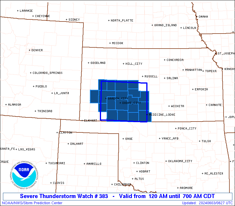
Initial List of Counties in SPC Severe Thunderstorm Watch 383 (WOU)
|
Back to Watch 383
|
 |
   WOUS64 KWNS 030619
   WOU3

   BULLETIN - IMMEDIATE BROADCAST REQUESTED
   SEVERE THUNDERSTORM WATCH OUTLINE UPDATE FOR WS 383
   NWS STORM PREDICTION CENTER NORMAN OK
   120 AM CDT MON JUN 3 2024

   SEVERE THUNDERSTORM WATCH 383 IS IN EFFECT UNTIL 700 AM CDT
   FOR THE FOLLOWING LOCATIONS

   KSC007-025-033-047-055-057-069-081-083-093-097-101-119-135-145-
   151-165-171-185-031200-
   /O.NEW.KWNS.SV.A.0383.240603T0620Z-240603T1200Z/

   KS
   .    KANSAS COUNTIES INCLUDED ARE

   BARBER               CLARK               COMANCHE
   EDWARDS              FINNEY              FORD
   GRAY                 HASKELL             HODGEMAN
   KEARNY               KIOWA               LANE
   MEADE                NESS                PAWNEE
   PRATT                RUSH                SCOTT
   STAFFORD


   ATTN...WFO...DDC...
|
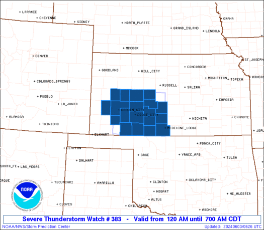
| Aviation Watch (SAW) for WW383 |
|---|
 |
| Note:
The Aviation Watch (SAW) product is an approximation to the watch area.
The actual watch is depicted by the shaded areas. |
   SAW3
   WW 383 SEVERE TSTM KS 030620Z - 031200Z
   AXIS..55 STATUTE MILES NORTH AND SOUTH OF LINE..
   15WSW GCK/GARDEN CITY KS/ - 35N P28/MEDICINE LODGE KS/
   ..AVIATION COORDS.. 50NM N/S /12WSW GCK - 48W ICT/
   HAIL SURFACE AND ALOFT..1.5 INCHES. WIND GUSTS..50 KNOTS.
   MAX TOPS TO 500. MEAN STORM MOTION VECTOR 30020.

   LAT...LON 38640097 38599858 37009858 37050097

   THIS IS AN APPROXIMATION TO THE WATCH AREA.  FOR A
   COMPLETE DEPICTION OF THE WATCH SEE WOUS64 KWNS
   FOR WOU3.
|
|


 @NWSSPC