 Note:
The expiration time in the watch graphic is amended if the watch is
replaced, cancelled or extended.
Note:
Note:
The expiration time in the watch graphic is amended if the watch is
replaced, cancelled or extended.
Note: Click for
Watch Status Reports.
SEL9
URGENT - IMMEDIATE BROADCAST REQUESTED
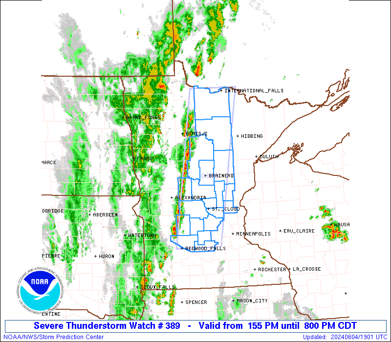
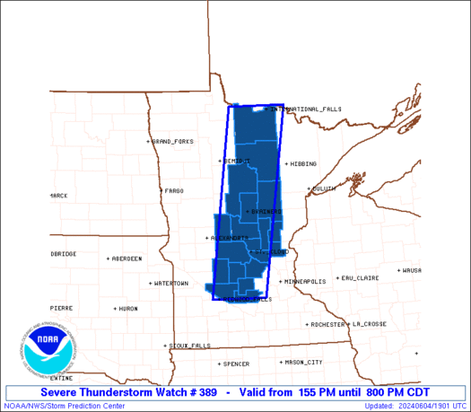
Severe Thunderstorm Watch Number 389
NWS Storm Prediction Center Norman OK
155 PM CDT Tue Jun 4 2024
The NWS Storm Prediction Center has issued a
* Severe Thunderstorm Watch for portions of
Central and Northern Minnesota
* Effective this Tuesday afternoon and evening from 155 PM until
800 PM CDT.
* Primary threats include...
Scattered damaging wind gusts to 65 mph possible
Scattered large hail events to 1.5 inches in diameter possible
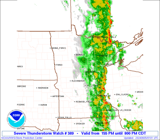
SUMMARY...A band of developing thunderstorms will continue to
intensify this afternoon. The stronger storms will potentially be
capable of strong to severe gusts (55-65 mph) and large hail. This
activity will spread from west to east across the Watch area through
the late afternoon and early evening.
The severe thunderstorm watch area is approximately along and 40
statute miles east and west of a line from 15 miles west northwest
of International Falls MN to 30 miles east of Redwood Falls MN. For
a complete depiction of the watch see the associated watch outline
update (WOUS64 KWNS WOU9).
PRECAUTIONARY/PREPAREDNESS ACTIONS...
REMEMBER...A Severe Thunderstorm Watch means conditions are
favorable for severe thunderstorms in and close to the watch area.
Persons in these areas should be on the lookout for threatening
weather conditions and listen for later statements and possible
warnings. Severe thunderstorms can and occasionally do produce
tornadoes.
&&
AVIATION...A few severe thunderstorms with hail surface and aloft to
1.5 inches. Extreme turbulence and surface wind gusts to 55 knots. A
few cumulonimbi with maximum tops to 400. Mean storm motion vector
22025.
...Smith
 Note:
The Aviation Watch (SAW) product is an approximation to the watch area.
The actual watch is depicted by the shaded areas.
Note:
The Aviation Watch (SAW) product is an approximation to the watch area.
The actual watch is depicted by the shaded areas.
   SAW9
   WW 389 SEVERE TSTM MN 041855Z - 050100Z
   AXIS..40 STATUTE MILES EAST AND WEST OF LINE..
   15WNW INL/INTERNATIONAL FALLS MN/ - 30E RWF/REDWOOD FALLS MN/
   ..AVIATION COORDS.. 35NM E/W /13WNW INL - 29E RWF/
   HAIL SURFACE AND ALOFT..1.5 INCHES. WIND GUSTS..55 KNOTS.
   MAX TOPS TO 400. MEAN STORM MOTION VECTOR 22025.

   LAT...LON 48659283 44559366 44559528 48659458

   THIS IS AN APPROXIMATION TO THE WATCH AREA.  FOR A
   COMPLETE DEPICTION OF THE WATCH SEE WOUS64 KWNS
   FOR WOU9.
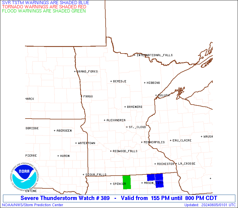
Watch 389 Status Report Messages:
STATUS REPORT #5 ON WW 389

VALID 050015Z - 050140Z

SEVERE WEATHER THREAT CONTINUES RIGHT OF A LINE FROM 35 E MKT TO
55 N ELO.

..LYONS..06/05/24

ATTN...WFO...DLH...MPX...

&&

STATUS REPORT FOR WS 389

SEVERE WEATHER THREAT CONTINUES FOR THE FOLLOWING AREAS

MNC017-115-050140-

MN
.    MINNESOTA COUNTIES INCLUDED ARE

CARLTON 	     PINE
$$


THE WATCH STATUS MESSAGE IS FOR GUIDANCE PURPOSES ONLY.  PLEASE
REFER TO WATCH COUNTY NOTIFICATION STATEMENTS FOR OFFICIAL
INFORMATION ON COUNTIES...INDEPENDENT CITIES AND MARINE ZONES
CLEARED FROM SEVERE THUNDERSTORM AND TORNADO WATCHES.
$$

STATUS REPORT #4 ON WW 389

VALID 042340Z - 050040Z

SEVERE WEATHER THREAT CONTINUES RIGHT OF A LINE FROM 5 NNW MKT TO
40 SE INL.

..THORNTON..06/04/24

ATTN...WFO...DLH...MPX...

&&

STATUS REPORT FOR WS 389

SEVERE WEATHER THREAT CONTINUES FOR THE FOLLOWING AREAS

MNC017-059-065-115-137-050040-

MN
.    MINNESOTA COUNTIES INCLUDED ARE

CARLTON 	     ISANTI		 KANABEC
PINE		     ST. LOUIS
$$


THE WATCH STATUS MESSAGE IS FOR GUIDANCE PURPOSES ONLY.  PLEASE
REFER TO WATCH COUNTY NOTIFICATION STATEMENTS FOR OFFICIAL
INFORMATION ON COUNTIES...INDEPENDENT CITIES AND MARINE ZONES
CLEARED FROM SEVERE THUNDERSTORM AND TORNADO WATCHES.
$$

STATUS REPORT #3 ON WW 389

VALID 042235Z - 042340Z

SEVERE WEATHER THREAT CONTINUES RIGHT OF A LINE FROM 20 SE RWF TO
30 SW STC TO 20 NE INL.

..THORNTON..06/04/24

ATTN...WFO...DLH...MPX...

&&

STATUS REPORT FOR WS 389

SEVERE WEATHER THREAT CONTINUES FOR THE FOLLOWING AREAS

MNC001-009-017-059-065-085-095-115-137-141-143-171-042340-

MN
.    MINNESOTA COUNTIES INCLUDED ARE

AITKIN		     BENTON		 CARLTON
ISANTI		     KANABEC		 MCLEOD
MILLE LACS	     PINE		 ST. LOUIS
SHERBURNE	     SIBLEY		 WRIGHT
$$


THE WATCH STATUS MESSAGE IS FOR GUIDANCE PURPOSES ONLY.  PLEASE
REFER TO WATCH COUNTY NOTIFICATION STATEMENTS FOR OFFICIAL
INFORMATION ON COUNTIES...INDEPENDENT CITIES AND MARINE ZONES
CLEARED FROM SEVERE THUNDERSTORM AND TORNADO WATCHES.
$$

STATUS REPORT #2 ON WW 389

VALID 042135Z - 042240Z

SEVERE WEATHER THREAT CONTINUES RIGHT OF A LINE FROM 15 SW RWF TO
25 W STC TO 15 NW INL.

..THORNTON..06/04/24

ATTN...WFO...DLH...MPX...

&&

STATUS REPORT FOR WS 389

SEVERE WEATHER THREAT CONTINUES FOR THE FOLLOWING AREAS

MNC001-009-017-035-059-061-065-085-093-095-115-137-141-143-171-
042240-

MN
.    MINNESOTA COUNTIES INCLUDED ARE

AITKIN		     BENTON		 CARLTON
CROW WING	     ISANTI		 ITASCA
KANABEC 	     MCLEOD		 MEEKER
MILLE LACS	     PINE		 ST. LOUIS
SHERBURNE	     SIBLEY		 WRIGHT
$$


THE WATCH STATUS MESSAGE IS FOR GUIDANCE PURPOSES ONLY.  PLEASE
REFER TO WATCH COUNTY NOTIFICATION STATEMENTS FOR OFFICIAL
INFORMATION ON COUNTIES...INDEPENDENT CITIES AND MARINE ZONES
CLEARED FROM SEVERE THUNDERSTORM AND TORNADO WATCHES.
$$

STATUS REPORT #1 ON WW 389

VALID 042030Z - 042140Z

THE SEVERE WEATHER THREAT CONTINUES ACROSS THE ENTIRE WATCH AREA.

..KERR..06/04/24

ATTN...WFO...DLH...MPX...

&&

STATUS REPORT FOR WS 389

SEVERE WEATHER THREAT CONTINUES FOR THE FOLLOWING AREAS

MNC001-009-021-035-059-061-065-067-071-085-093-095-097-129-141-
143-145-153-171-042140-

MN
.    MINNESOTA COUNTIES INCLUDED ARE

AITKIN		     BENTON		 CASS
CROW WING	     ISANTI		 ITASCA
KANABEC 	     KANDIYOHI		 KOOCHICHING
MCLEOD		     MEEKER		 MILLE LACS
MORRISON	     RENVILLE		 SHERBURNE
SIBLEY		     STEARNS		 TODD
WRIGHT
$$


THE WATCH STATUS MESSAGE IS FOR GUIDANCE PURPOSES ONLY.  PLEASE
REFER TO WATCH COUNTY NOTIFICATION STATEMENTS FOR OFFICIAL
INFORMATION ON COUNTIES...INDEPENDENT CITIES AND MARINE ZONES
CLEARED FROM SEVERE THUNDERSTORM AND TORNADO WATCHES.
$$
Note:
Click for Complete Product Text.
Tornadoes
Probability of 2 or more tornadoes
|
Low (10%)
|
Probability of 1 or more strong (EF2-EF5) tornadoes
|
Low (<2%)
|
Wind
Probability of 10 or more severe wind events
|
Mod (40%)
|
Probability of 1 or more wind events > 65 knots
|
Low (20%)
|
Hail
Probability of 10 or more severe hail events
|
Mod (40%)
|
Probability of 1 or more hailstones > 2 inches
|
Low (20%)
|
Combined Severe Hail/Wind
Probability of 6 or more combined severe hail/wind events
|
High (70%)
|
For each watch, probabilities for particular events inside the watch
(listed above in each table) are determined by the issuing forecaster.
The "Low" category contains probability values ranging from less than 2%
to 20% (EF2-EF5 tornadoes), less than 5% to 20% (all other probabilities),
"Moderate" from 30% to 60%, and "High" from 70% to greater than 95%.
High values are bolded and lighter in color to provide awareness of
an increased threat for a particular event.


 @NWSSPC