|
| Mesoscale Discussion 842 |
|
< Previous MD Next MD >
|
|
Mesoscale Discussion 0842
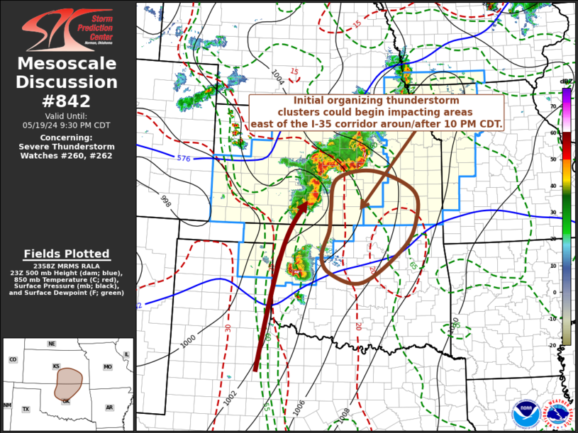
NWS Storm Prediction Center Norman OK
0700 PM CDT Sun May 19 2024
Areas affected...south central/southeastern Kansas and north
central/northeastern Oklahoma
Concerning...Severe Thunderstorm Watch 260...262...
Valid 200000Z - 200230Z
The severe weather threat for Severe Thunderstorm Watch 260, 262
continues.
SUMMARY...Organizing convective clusters accompanied by potentially
strong, damaging wind gusts may increasingly impact areas east of
the Interstate 35 corridor of southeastern Kansas and northeastern
Oklahoma after 10 PM. Trends are being monitored for an additional
severe weather watch across northeastern Oklahoma.
DISCUSSION...Convective evolution into late evening remains somewhat
unclear. As a low amplitude mid-level short wave progresses across
central Kansas toward the lower Missouri Valley, mid-level warming
is forecast across much of Oklahoma. Coupled with the onset of
boundary-layer cooling, this will contribute to increasing
inhibition, with the nose of a strengthening southerly low-level jet
(50+ kt around 850 mb) becoming focused over southwestern/south
central Kansas near Medicine Loge.
However, a corridor of higher moisture content air remains focused
east of the dryline through areas near/just east of the Interstate
35 corridor. Supported by inflow of this air, with CAPE up to
around 3000 J/kg, ongoing convection may continue to grow upscale
and organize further during the next few hours, and potentially
begin to impact portions of southeastern Kansas/northeastern
Oklahoma as early as 03-05Z.
..Kerr/Smith.. 05/20/2024
...Please see www.spc.noaa.gov for graphic product...
ATTN...WFO...TSA...TOP...ICT...OUN...
LAT...LON 38399682 37879553 37079548 36369593 35539719 35769820
36219846 36879823 37409819 38189801 38399682
|
|
Top/All Mesoscale Discussions/Forecast Products/Home
|
|


 @NWSSPC