|
| Mesoscale Discussion 1052 |
|
< Previous MD Next MD >
|
|
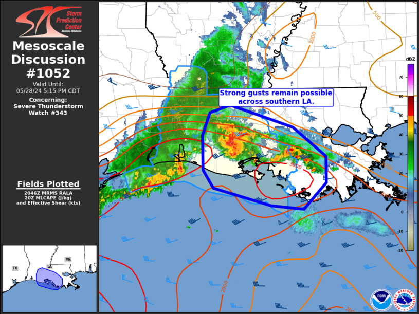
   Mesoscale Discussion 1052
   NWS Storm Prediction Center Norman OK
   0348 PM CDT Tue May 28 2024

   Areas affected...southern Louisiana

   Concerning...Severe Thunderstorm Watch 343...

   Valid 282048Z - 282215Z

   The severe weather threat for Severe Thunderstorm Watch 343
   continues.

   SUMMARY...Strong to severe gust potential continues across Severe
   Thunderstorm Watch 343 in southern Louisiana.

   DISCUSSION...A cluster of thunderstorms along a surface boundary
   over southern Louisiana will continue to propagate generally
   east/southeast over the next few hours. Forward propagation of this
   cluster has slowed from earlier this afternoon. However, a very
   moist and unstable boundary layer will continue to promote strong to
   severe gusts in the 50-65 mph range. Convection should approach the
   coast and move offshore by early evening.

   ..Leitman.. 05/28/2024

   ...Please see www.spc.noaa.gov for graphic product...

   ATTN...WFO...LIX...LCH...

   LAT...LON   30729237 30349116 29869052 29419053 28989095 29049157
               29329268 29629288 30209290 30589275 30729237
|
|
Top/All Mesoscale Discussions/Forecast Products/Home
|
|


 @NWSSPC