|
| Mesoscale Discussion 1207 |
|
< Previous MD Next MD >
|
|
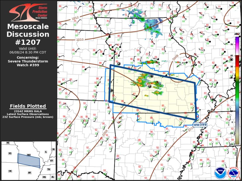
   Mesoscale Discussion 1207
   NWS Storm Prediction Center Norman OK
   0658 PM CDT Sat Jun 08 2024

   Areas affected...Southern Missouri Region

   Concerning...Severe Thunderstorm Watch 399...

   Valid 082358Z - 090130Z

   The severe weather threat for Severe Thunderstorm Watch 399
   continues.

   SUMMARY...Convection should increase across ww399 this evening along
   with an attendant severe risk for wind/hail.

   DISCUSSION...Weak short-wave ridging is expected to gradually relax
   this evening. This is supported by a recent uptik in convection
   south of a weak surface boundary that is currently draped east-west,
   just south of I70. Visible satellite imagery depicts a considerable
   amount of agitated cu from southeast KS into south-central MO where
   several robust thunderstorm clusters are maturing. This activity is
   evolving within a very unstable air mass, and cloud tops suggest
   these updrafts are processing air efficiently. Current thinking is a
   considerable amount of convection may ultimately evolve across ww399
   and large hail and damaging winds are possible with these storms.

   ..Darrow.. 06/08/2024

   ...Please see www.spc.noaa.gov for graphic product...

   ATTN...WFO...PAH...MEG...LSX...LZK...SGF...EAX...TSA...

   LAT...LON   38549480 37779021 36179019 36969482 38549480
|
|
Top/All Mesoscale Discussions/Forecast Products/Home
|
|


 @NWSSPC